Solar eclipse maps from 1961 to 1970


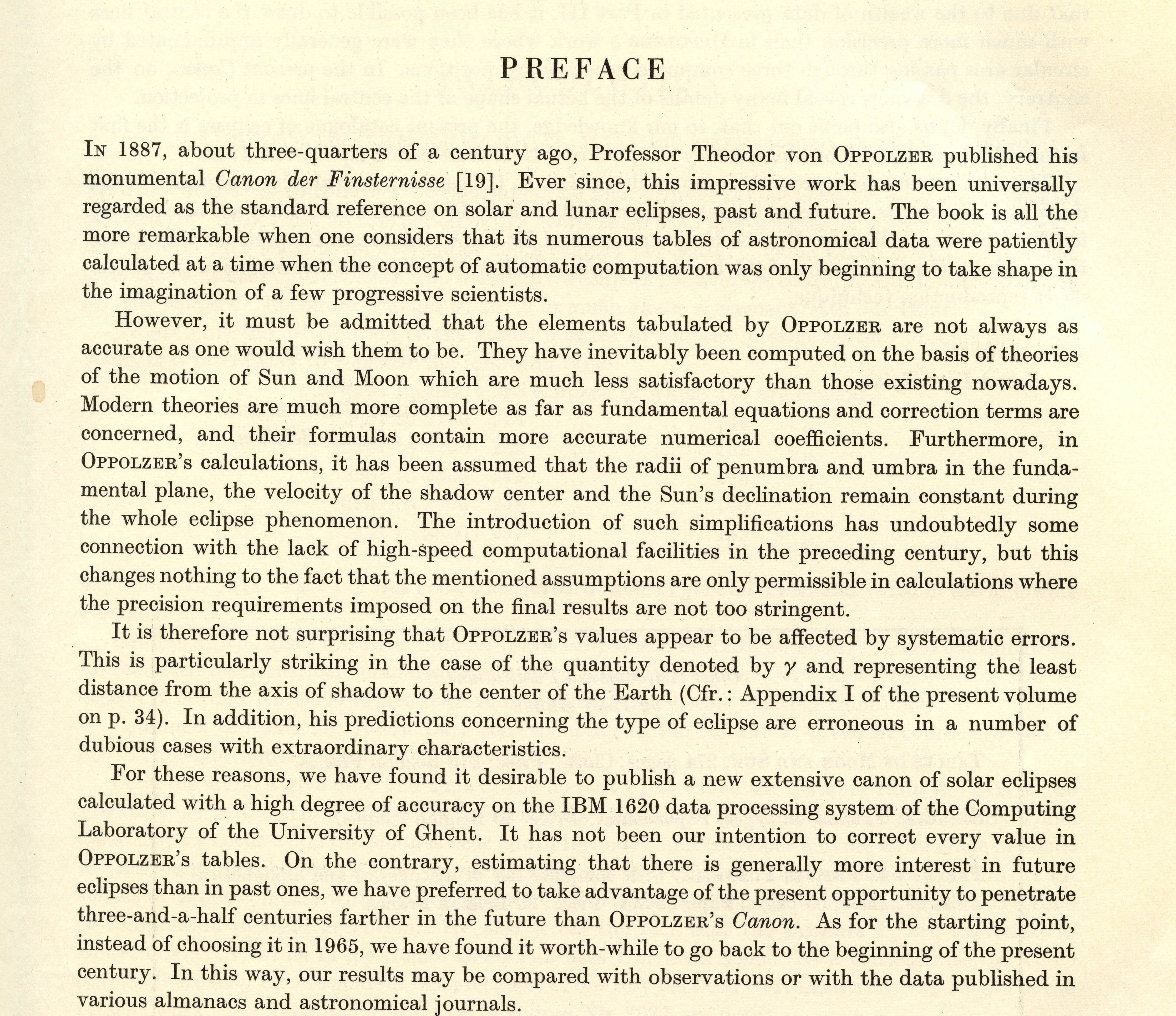
In 1887, Theodor von Oppolzer published his epic Canon der Finsternisse (canon of eclipses). For decades, this work remained the comprehensive record of eclipses for many centuries past and future.
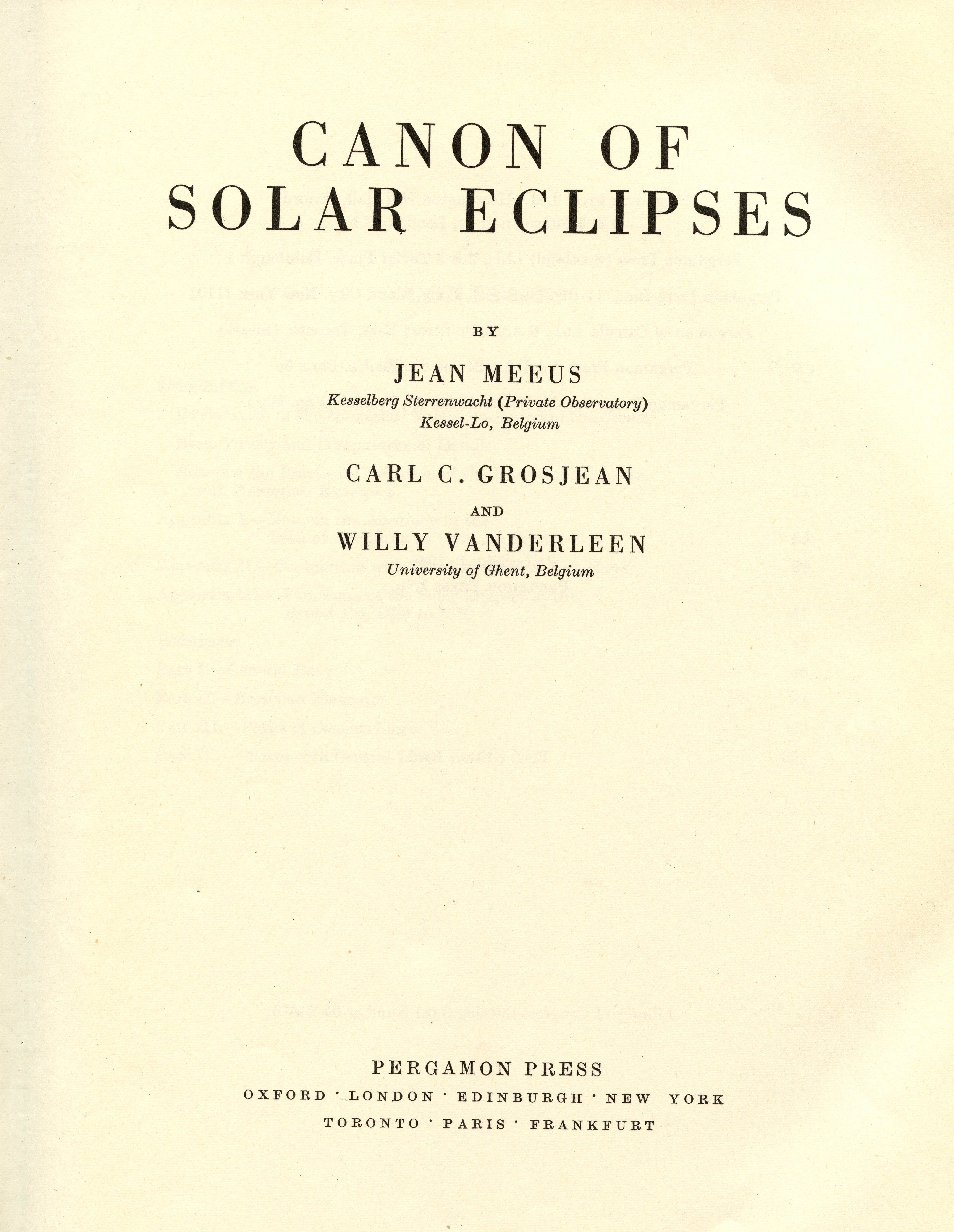
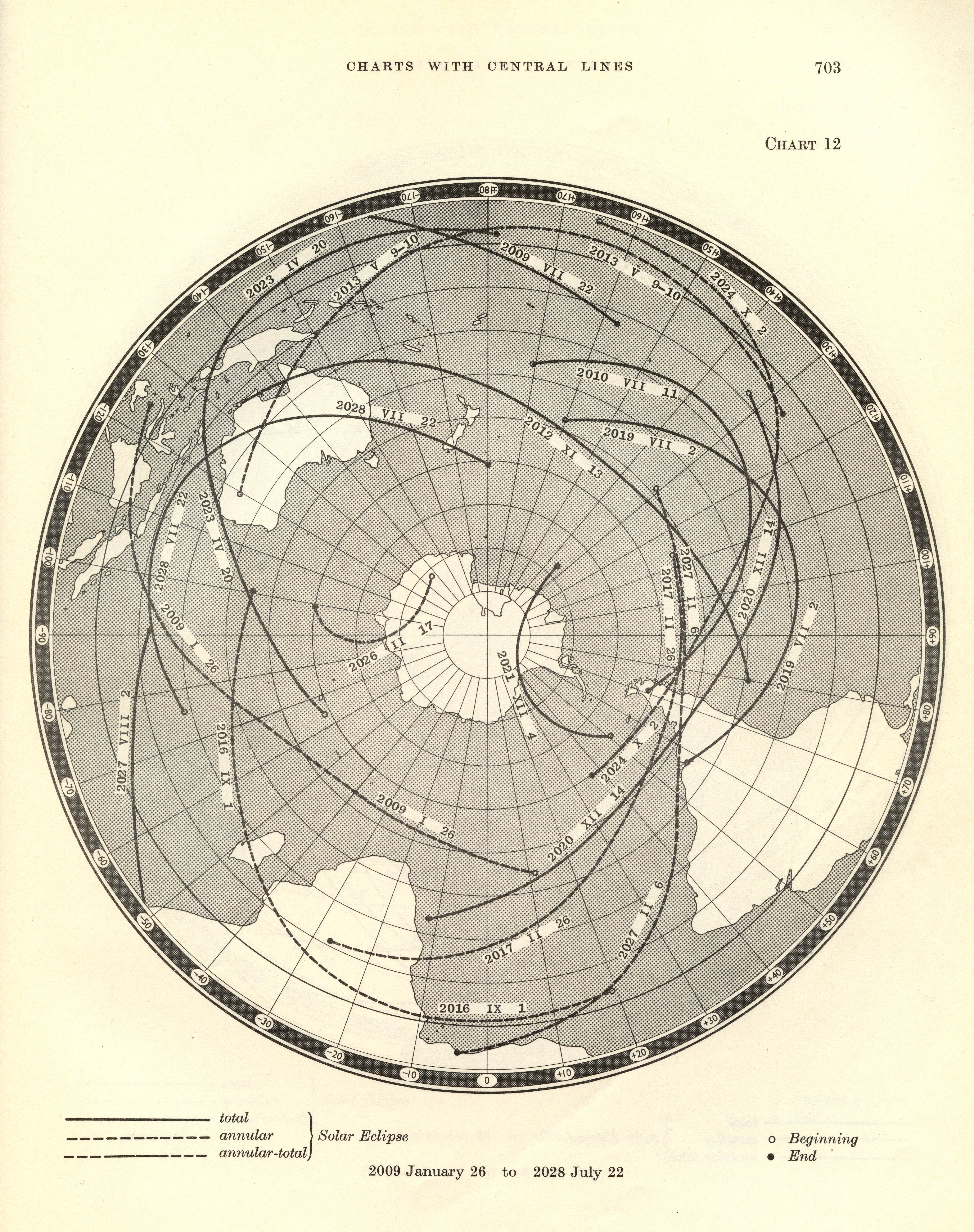
It was not until 1966 until Oppolzer’s achievement was met with another similarly ambitious opus, the Canon of Solar Eclipses by Jean Meeus, Carl Grosjean, and Willy Vanderleen, all of Belgium. The range of eclipses in this work span from 1900 to 2509.
As you can read in the extract from the Preface, the calculations were done with an IBM 1620 data processing system. Thus, instead of three points calculated per eclipse, many points were calculated for each eclipse path with a much higher degree of accuracy.
Both the Canon der Finsternisse and Canon of Solar Eclipses share another innovation; the adoption of a new time scale useful for global and astronomical applications. Oppolzer had the foresight to apply Greenwich Mean Time for his work which made it useful throughout the world. The adoption of the Prime Meridian at Greenwich was just adopted by international agreement in 1884. Meeus, Grosjean, and Vanderleen likewise were early adopters of Ephemeris Time, internationally adopted in 1952 as a uniform time scale regulated by atomic clocks.
Sources
The maps from the American Ephemeris and Nautical Almanac from 1961 to 1970 are either scanned from the collection of Michael Zeiler or from holdings at the Federal Depository Library in Albuquerque, N.M.
The eclipse maps from the Royal Astronomical Society of Canada are fromhttp://www.rasc.ca/observing/solareclipses/history.shtml.
The sketch map of the 1970 eclipse by Donald Menzel is from http://web.williams.edu/Astronomy/eclipse/eclipse1970/MenzelandPasachoff.pdf.
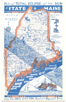
The Soviet eclipse poster is from http://www.eclipse-2008.ru/eclipse/1961.php. The 1963 postcard by A.O. Phillips is courtesy of Bill Kramer. The 1963 postcard by Augustus Phillips is from the collection of Michael Zeiler. The 1966 Canon of Solar Eclipses is in the collection of Michael Zeiler.
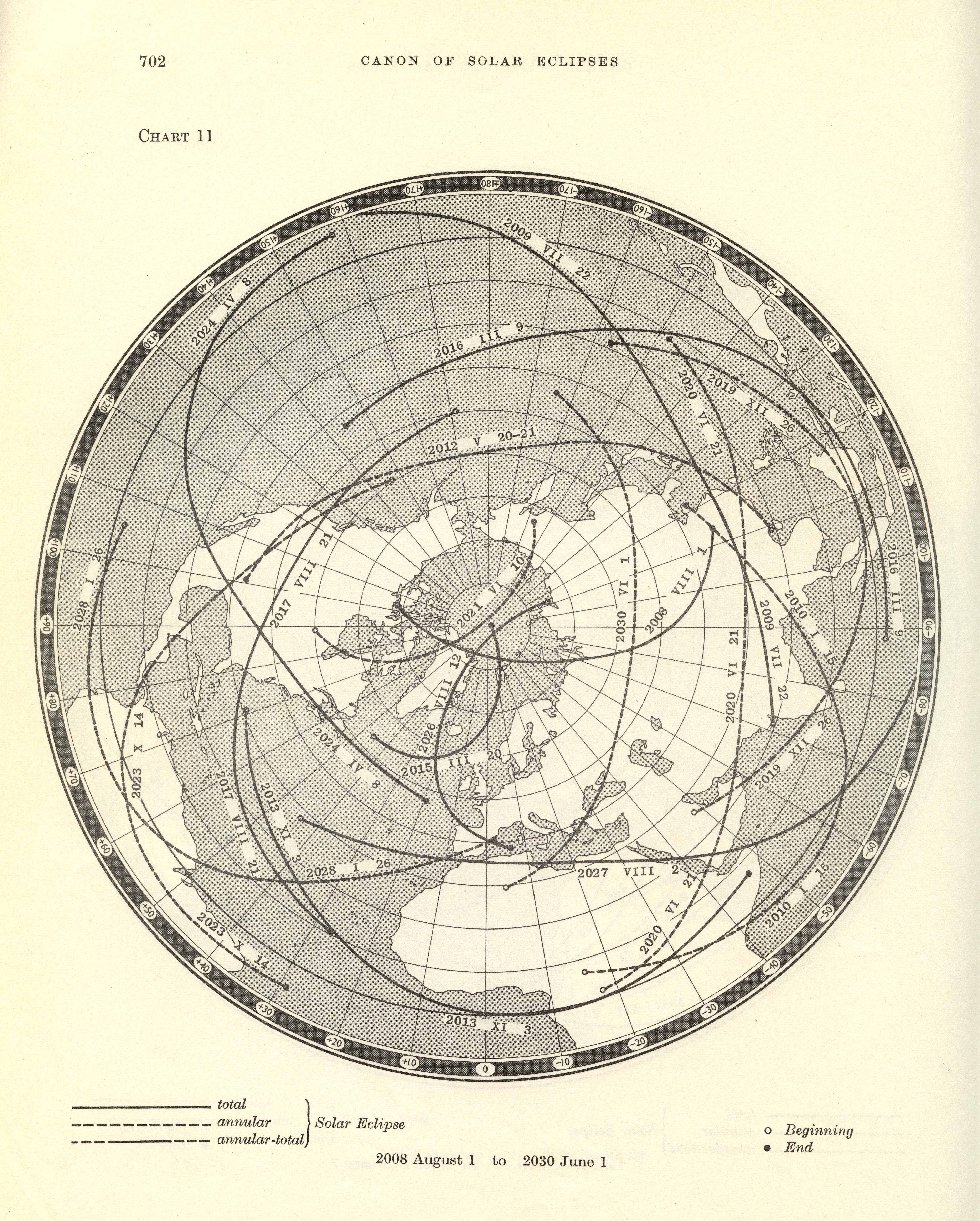
The maps in the Canon of Solar Eclipses are very similar in cartographic form to the maps in Canon der Finsternisse, both applying planar equidistant projections centered on a global pole. The chief difference is that the 1966 Canon contains maps for both the northern and southern hemispheres, whereas the 1887 Canon contains maps only for the northern hemisphere.
Several eclipses this decade passed over populated areas and were widely observed. The eclipse of February 15,1961 passed over southern Europe into the Soviet Union, commemorated by the poster above. The eclipse of July 20, 1963 passed over Alaska, Canada, and Maine. The eclipse of March 7,1970 grazed the Eastern seaboard of the United States. For a video account from a contemporary news broadcast, see http://abcnews.go.com/Archives/video/march-1970-total-solar-eclipse-9656999