Solar eclipse maps from 1951 to 1960
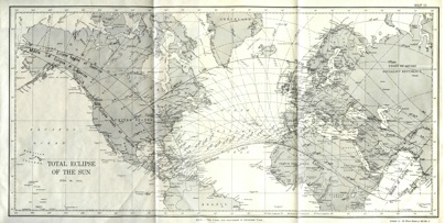
The United States Naval Observatory published a supplement to the American Ephemeris and Nautical Almanac for the total eclipse on June 30, 1954. The path of the total eclipse swept over three continents; North America, Europe, and then Asia.
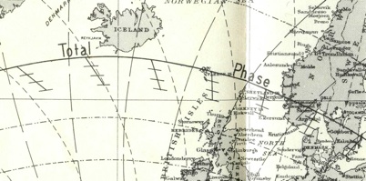
Close examination of the overview map contained within the supplement shows a curious feature not seen on any earlier eclipse map. What are these features south of the central line with an angled line and three short line segments roughly parallel to the path of total solar eclipse?
A careful reading of the USNO supplement reveals that these lines are the paths of the eclipse at elevations of 100 km, 200 km, and 300 km above the surface of the earth.
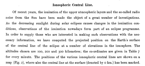
1954 is just before the dawn of the space age. So why were these lines for the path at elevations added? A reading of another document for the same eclipse from Norway gives the answer: “Of recent years, the ionization of the upper atmospheric layers and the so-called radio noise from the Sun have been made the object of a great number of investigations.”
Overview map from the Supplement to the American Ephemeris, 1954
Detail from above overview map, with path of eclipse marked at the earth’s surface and 100 km, 200 km, and 300 km about the surface.
Explanation from Grönstrand’s prediction as to why eclipse predictions for 100 km, 200 km, and 300 km about the surface were of interest. One of Grönstrand’s map in the album below contains four paths of the solar eclipse for these elevations.
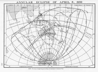
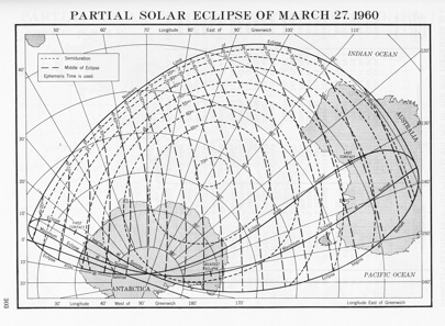
Eclipse maps are spatio-temporal documents. That is, they communicate characteristics of an eclipse as it develops in both space and time. As you study eclipse maps over over the decades, you can see that the information they present evolves. From 1959 to 1960, there was a stylistic change in the maps published in the American Ephemeris and Nautical Almanac. The 1959 map on the left displays the eclipse limit lines and the begin and end of the partial phase of eclipse (1st and 4th contacts of eclipse.) The 1960 map on the right displays isochrons for the time of greatest eclipse as well as isolines for semiduration, which is the duration of eclipse from the begin to end of partial phase of eclipse.
Sources
The maps from the American Ephemeris and Nautical Almanac from 1941 to 1950 are either scanned from the collection of Michael Zeiler or from holdings at the Federal Depository Library in Albuquerque, N.M. The 1954 Supplement to the American Ephemeris is in the collection of Michael Zeiler.
The eclipse maps from the Royal Astronomical Society of Canada and Grönstrand’s maps of Scandinavia can be found by searches on the NASA Astrophysics Data System at http://articles.adsabs.harvard.edu.
