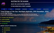
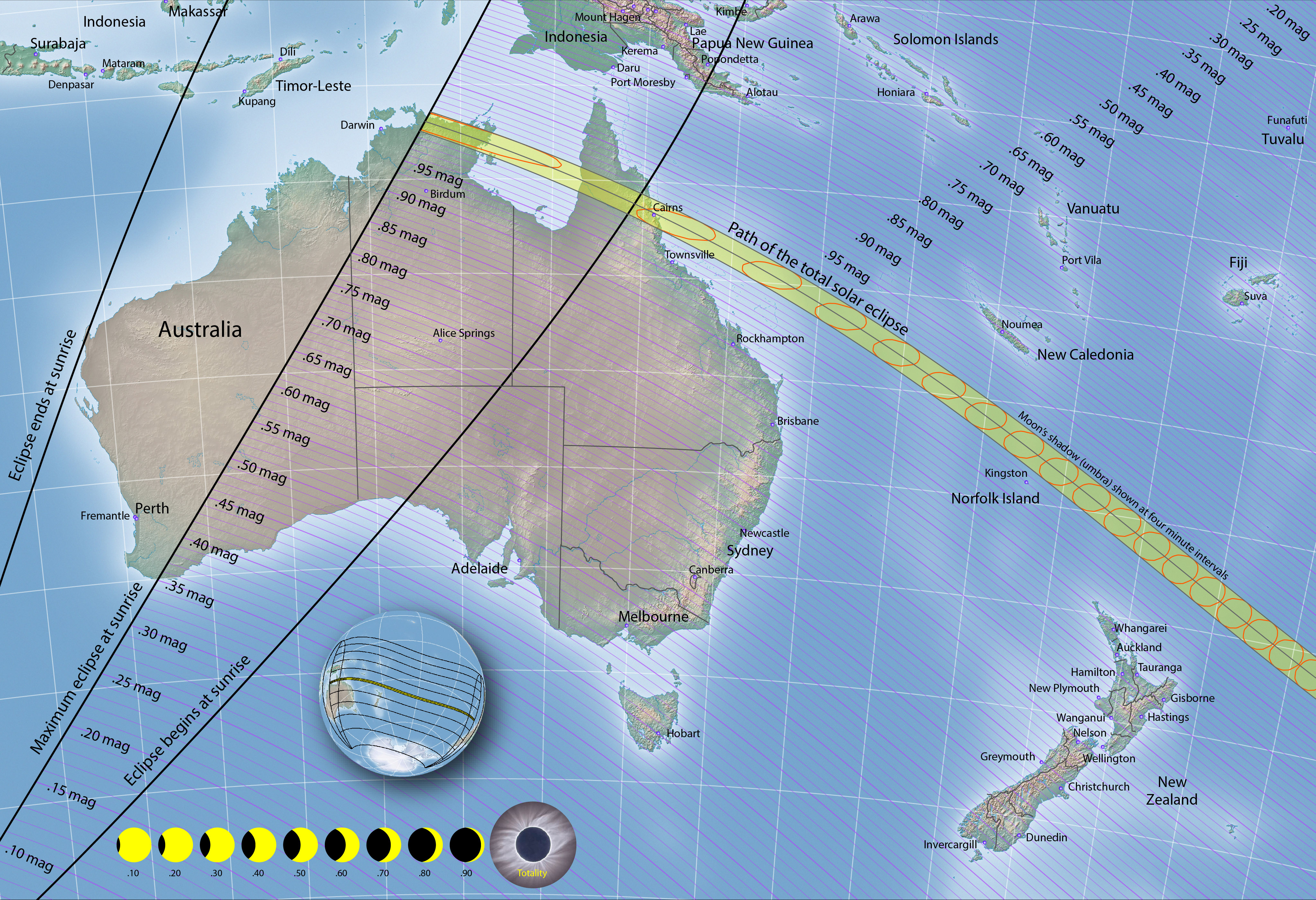
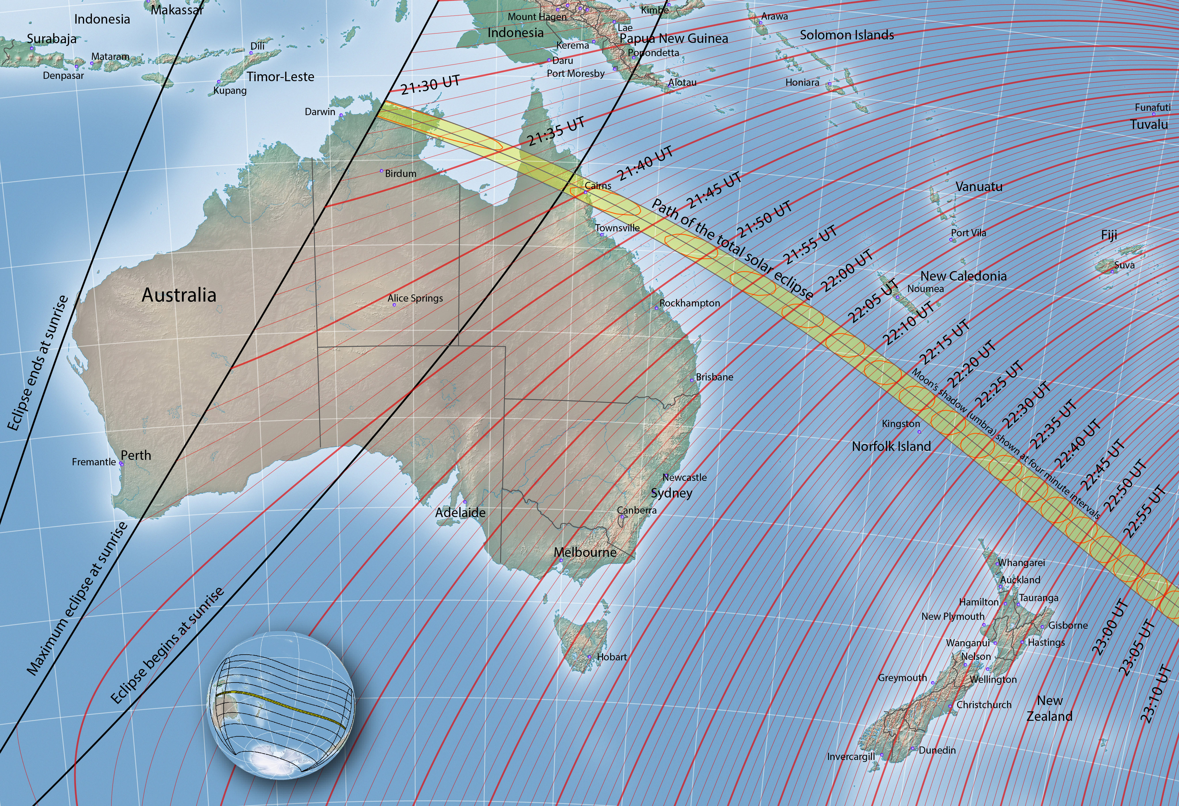
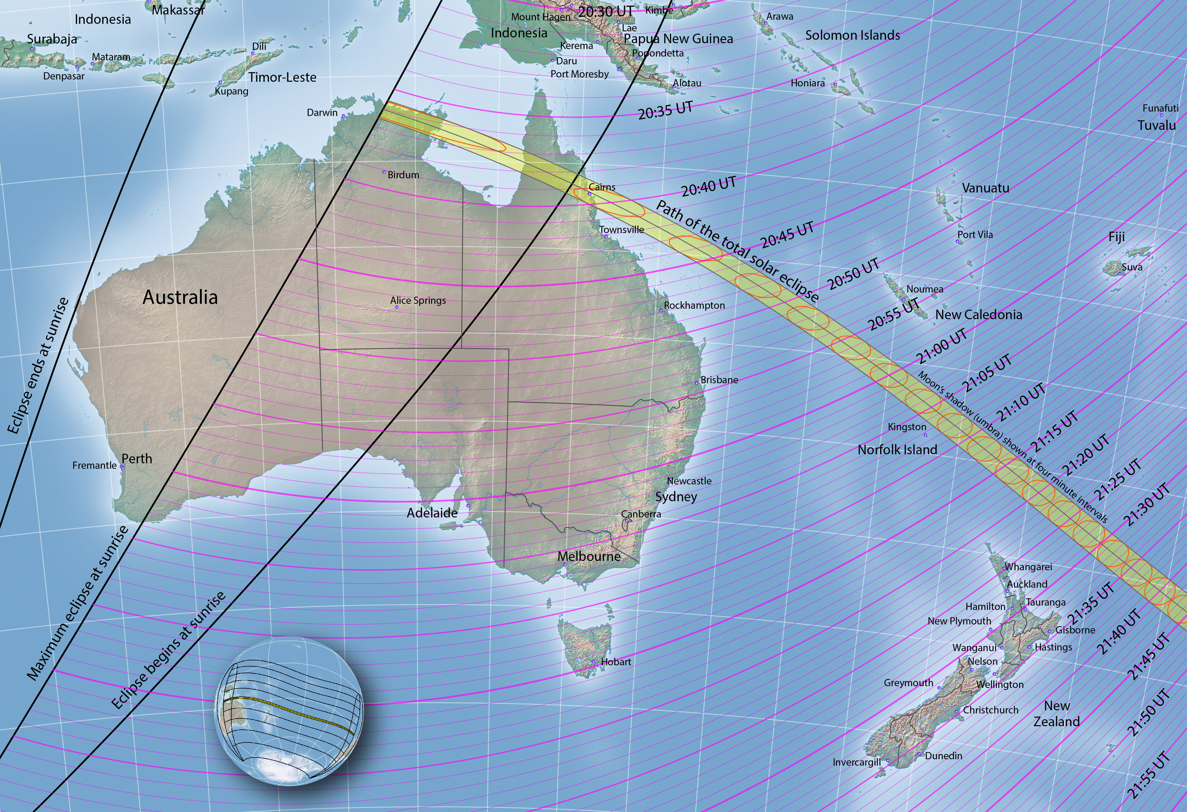
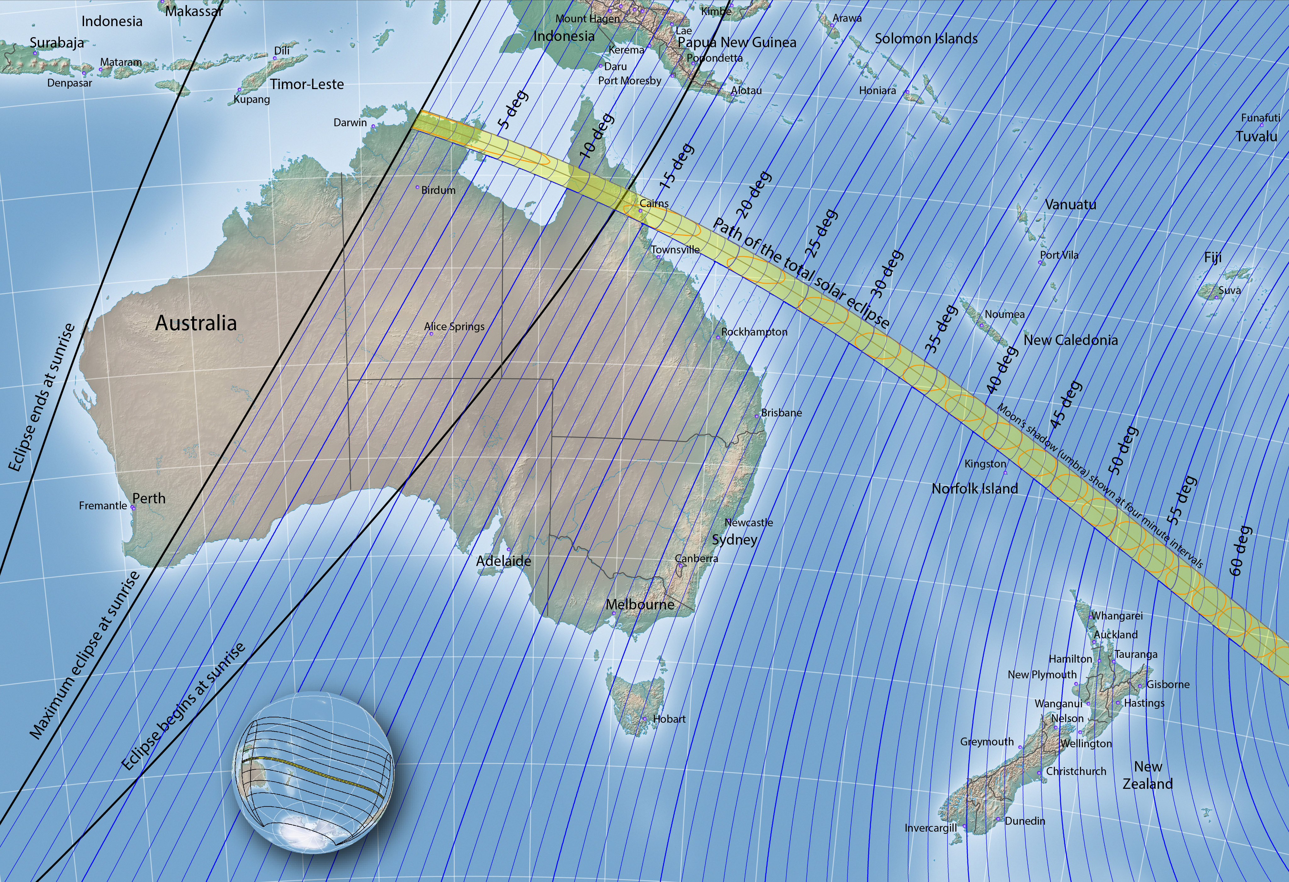
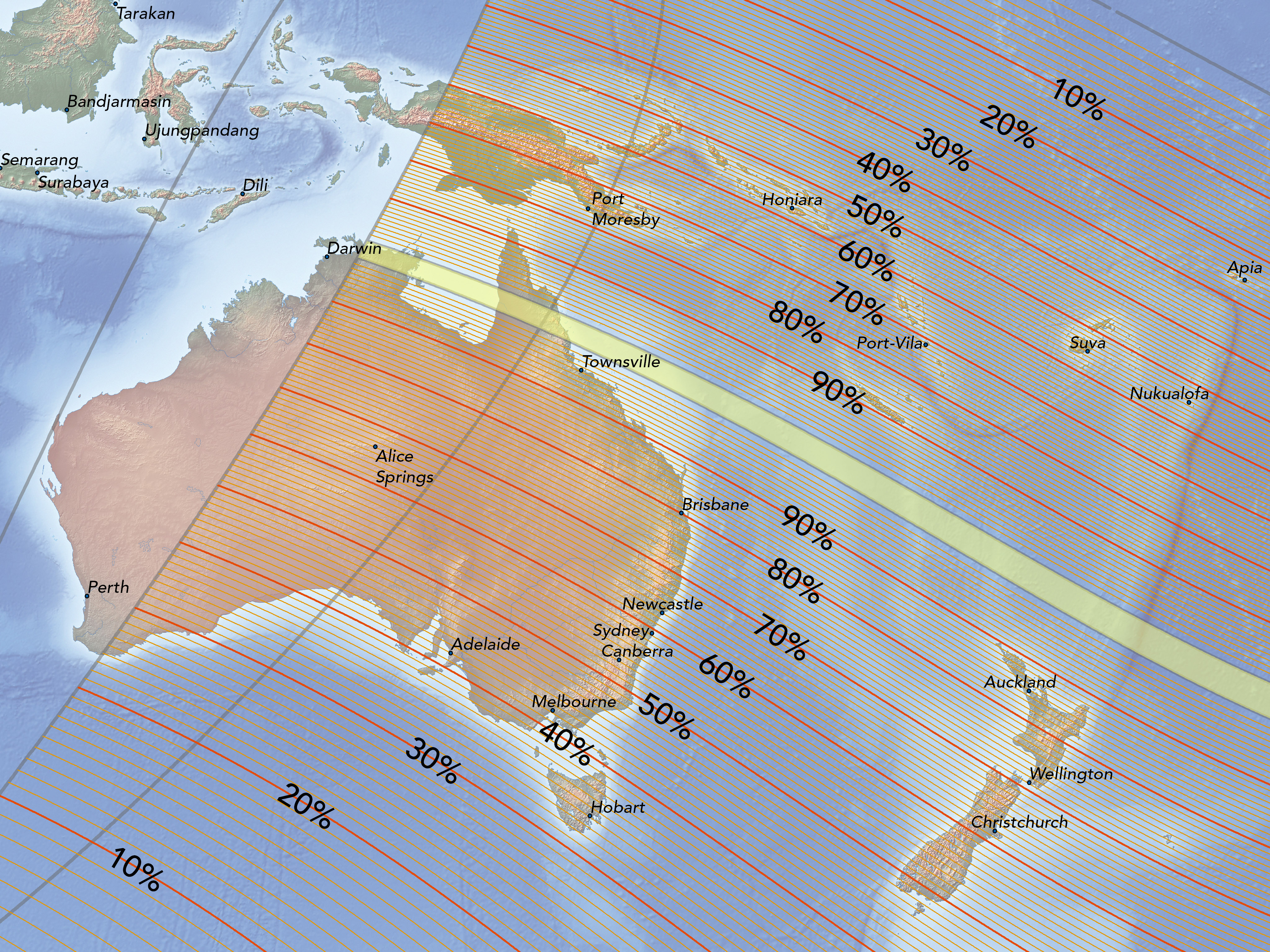
This total solar eclipse begins in Arnhem Land of northern Australia, crosses the Gulf of Carpentaria, passes over northern Queensland, and then sweeps over the span of the Pacific Ocean. Once totality exits the Great Barrier Reef in the vicinity of Cairns, no further landfall is made. Norfolk Island is close to, but just south of the path of totality. New Zealand will experience a deep partial eclipse.
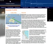
Total solar eclipse of November 13-14, 2012


Stylish eclipse t-shirts and maps here
NASA 2012 eclipse page
2012 eclipse weather
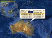
Interactive google eclipse map
2012 maps and resources
High dynamic range photos
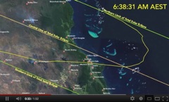
Cairns eclipse information
Got iPad? Then check out my eclipse atlas in the iBooks format for iPads. You can download a free sample or purchase the iBook at https://itunes.apple.com/us/book/total-solar-eclipse-november/id568448997?mt=11&ls=1
Click below to see some of my favorite eclipse web sites
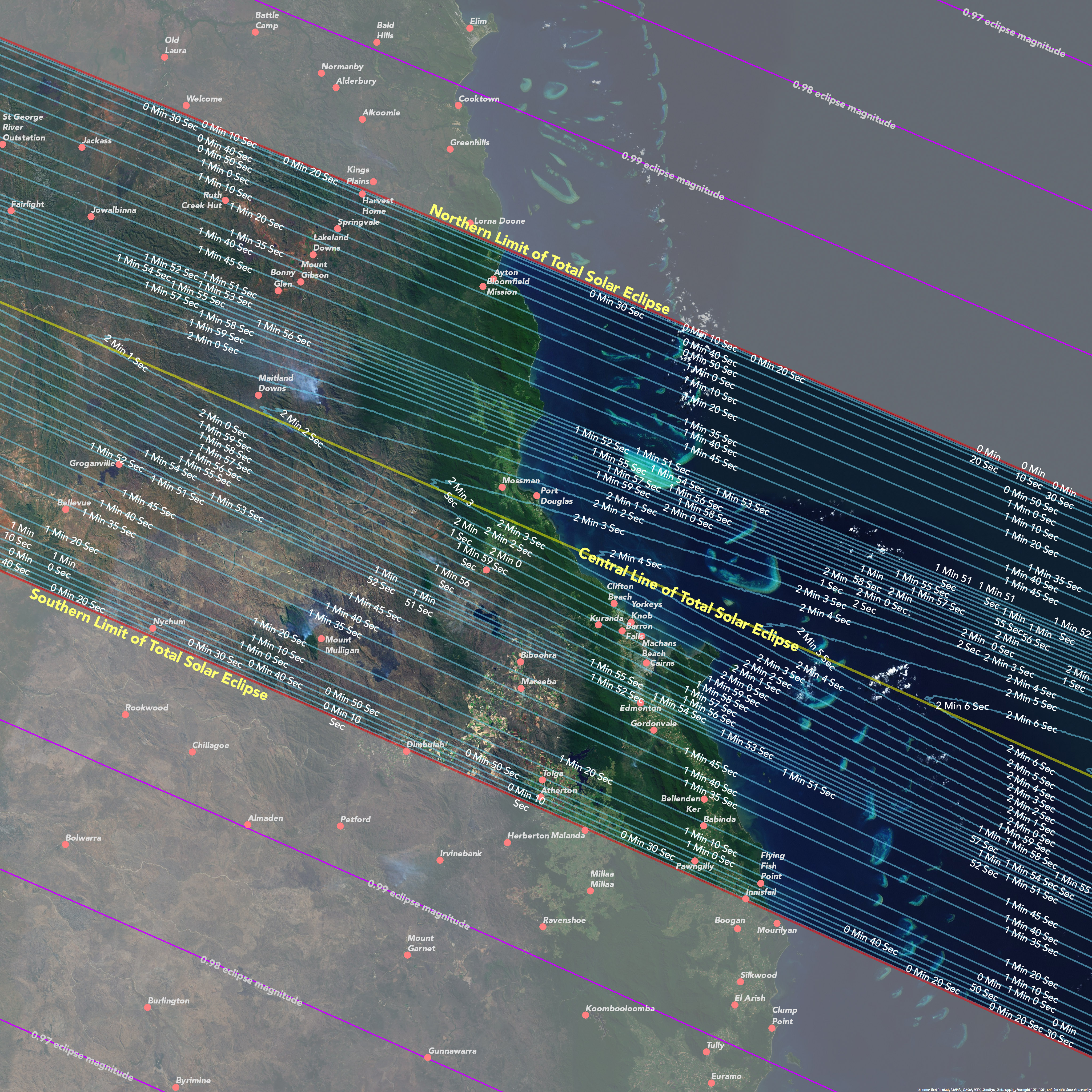
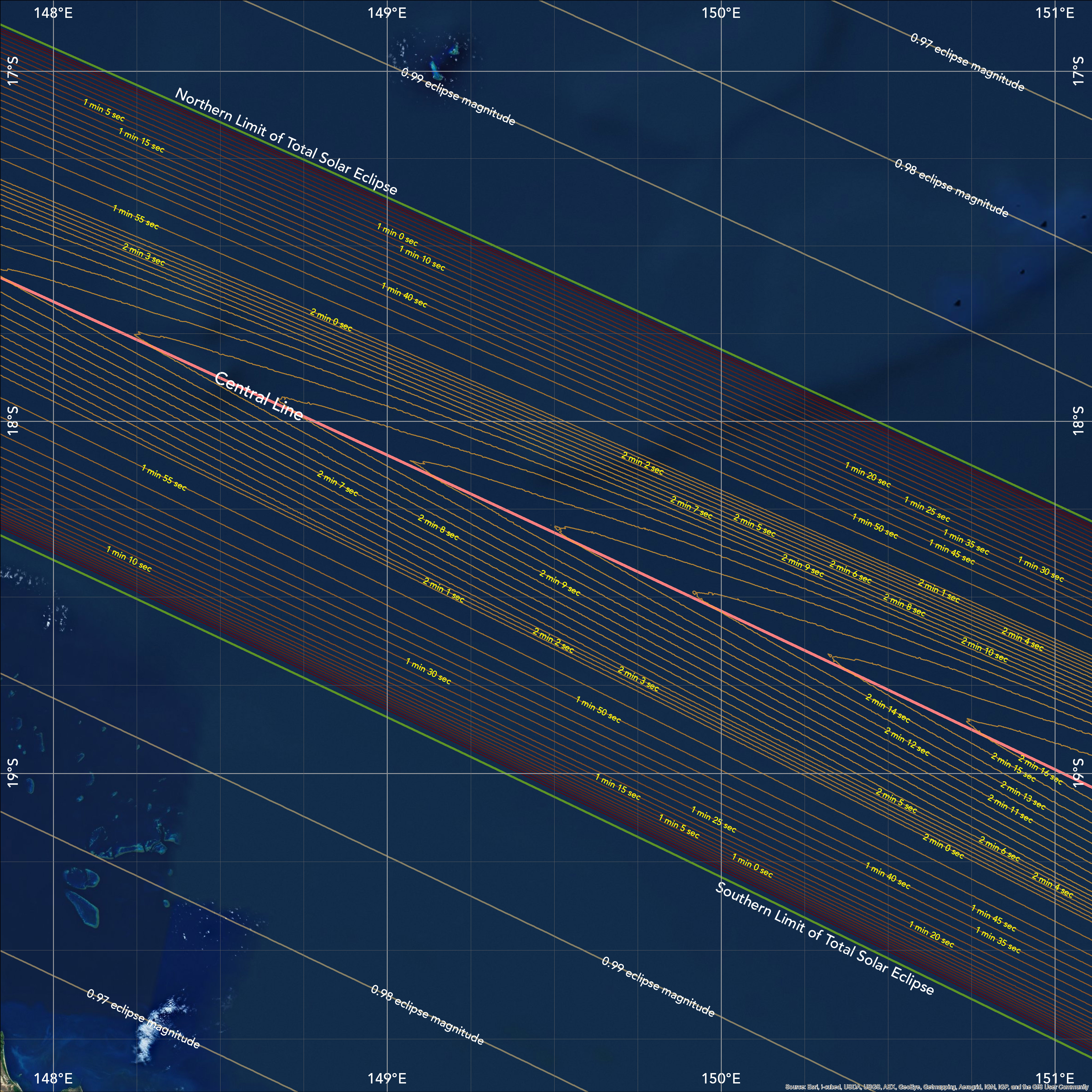
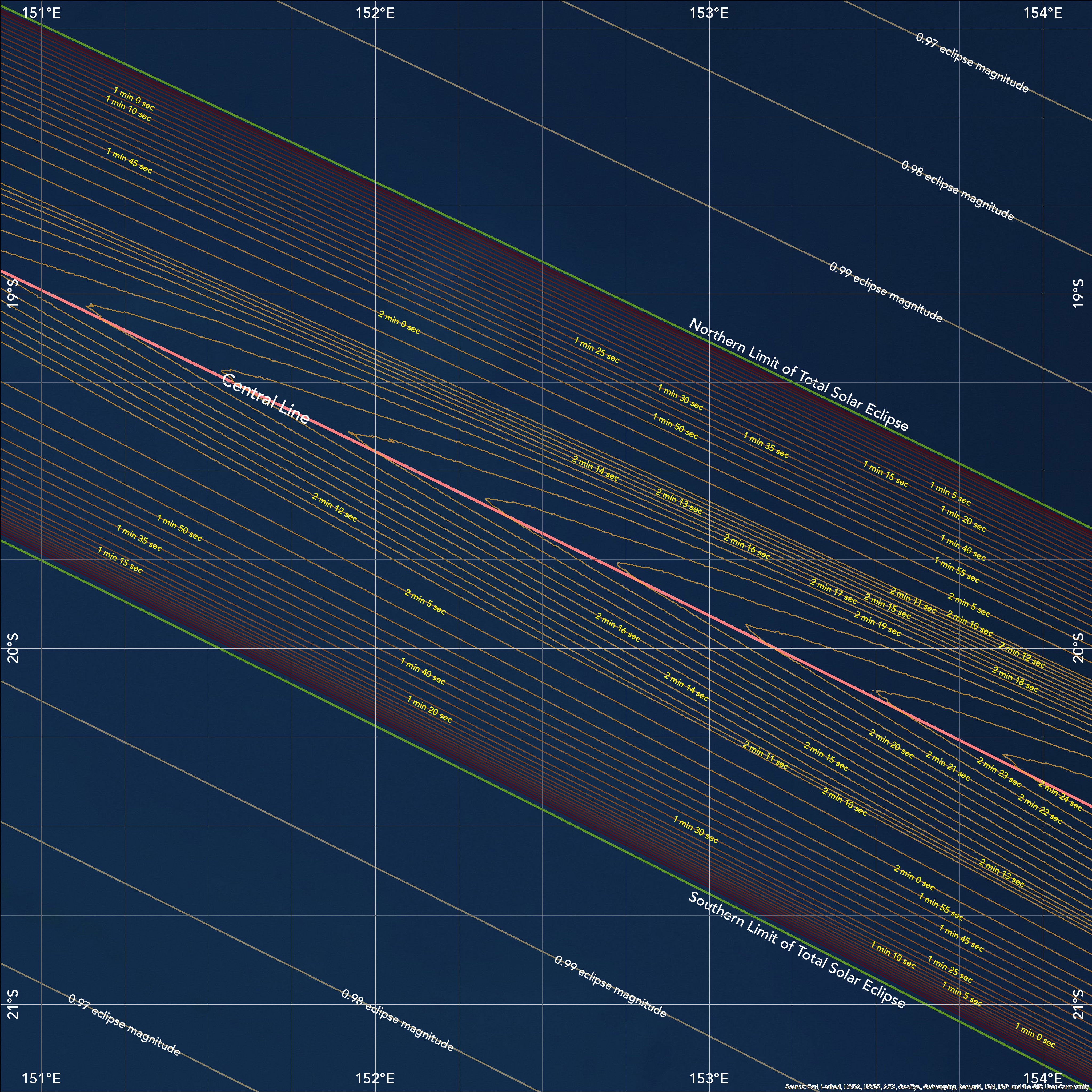
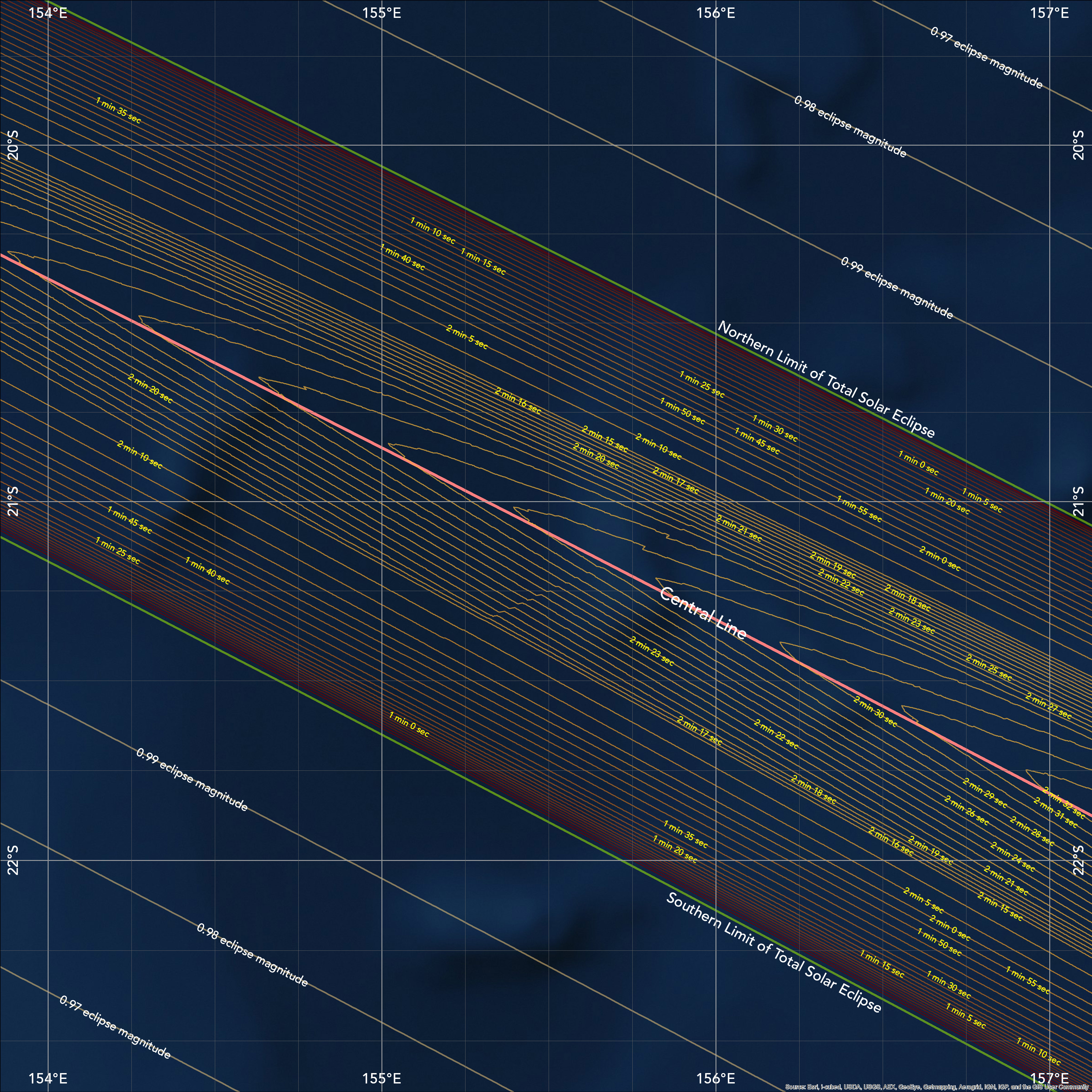
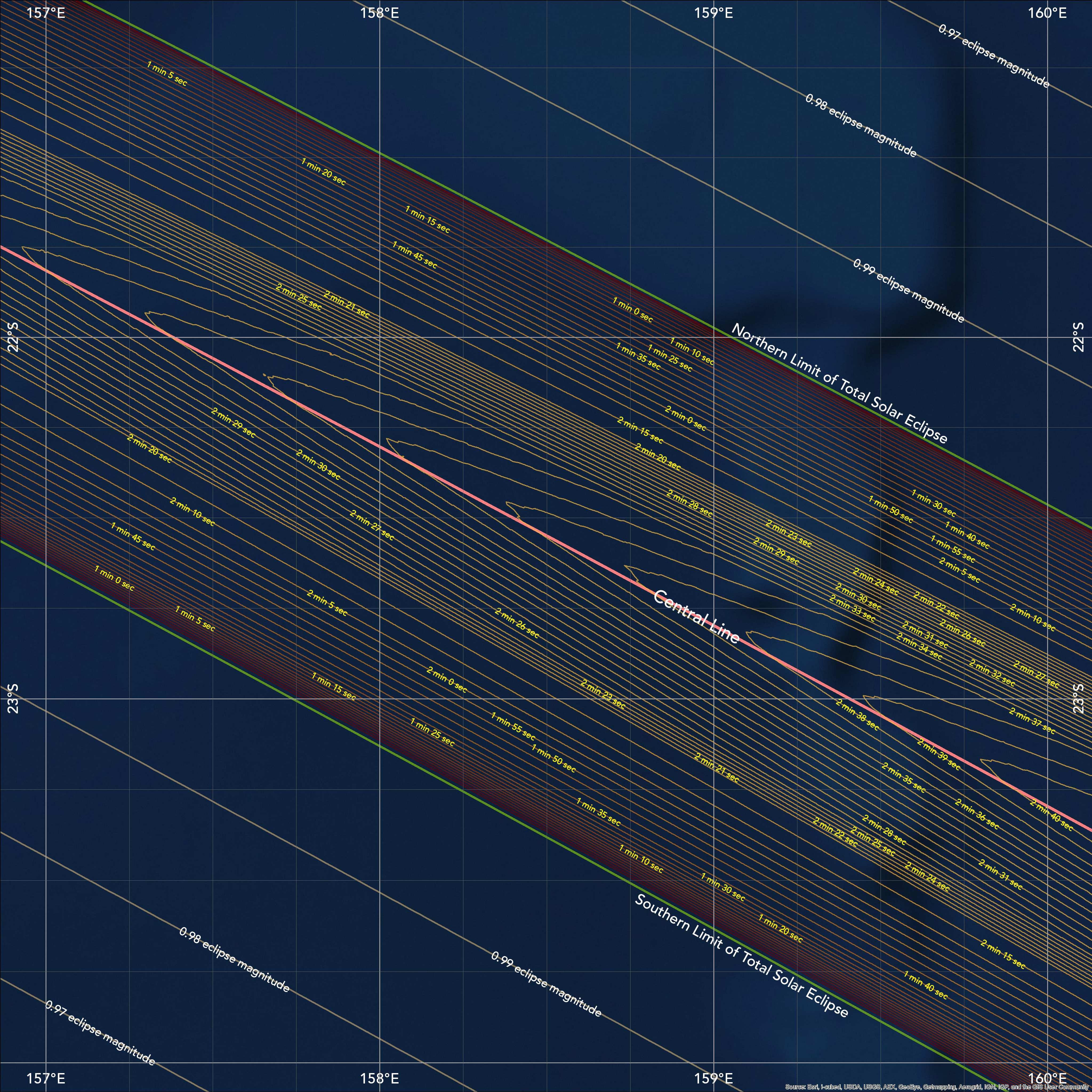
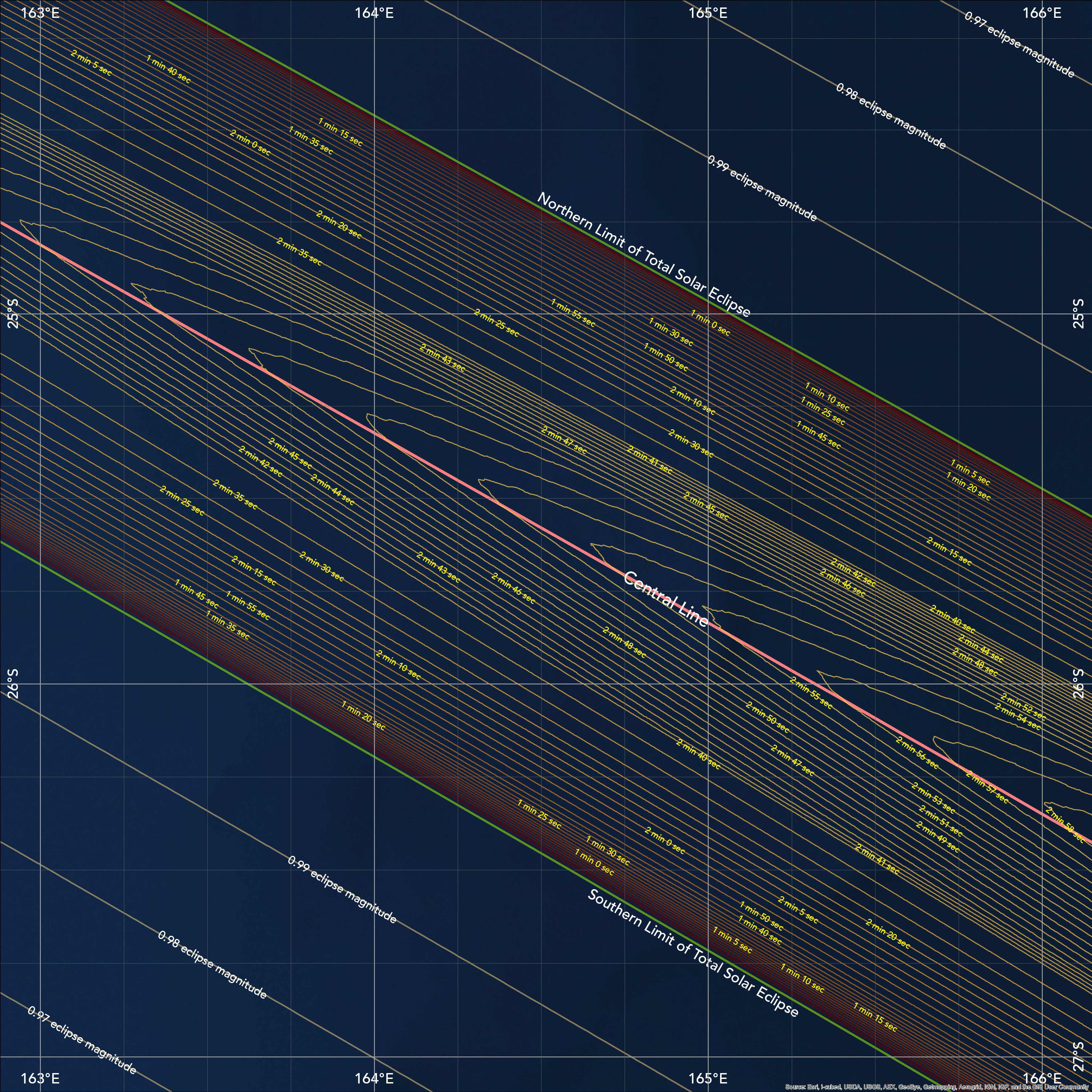
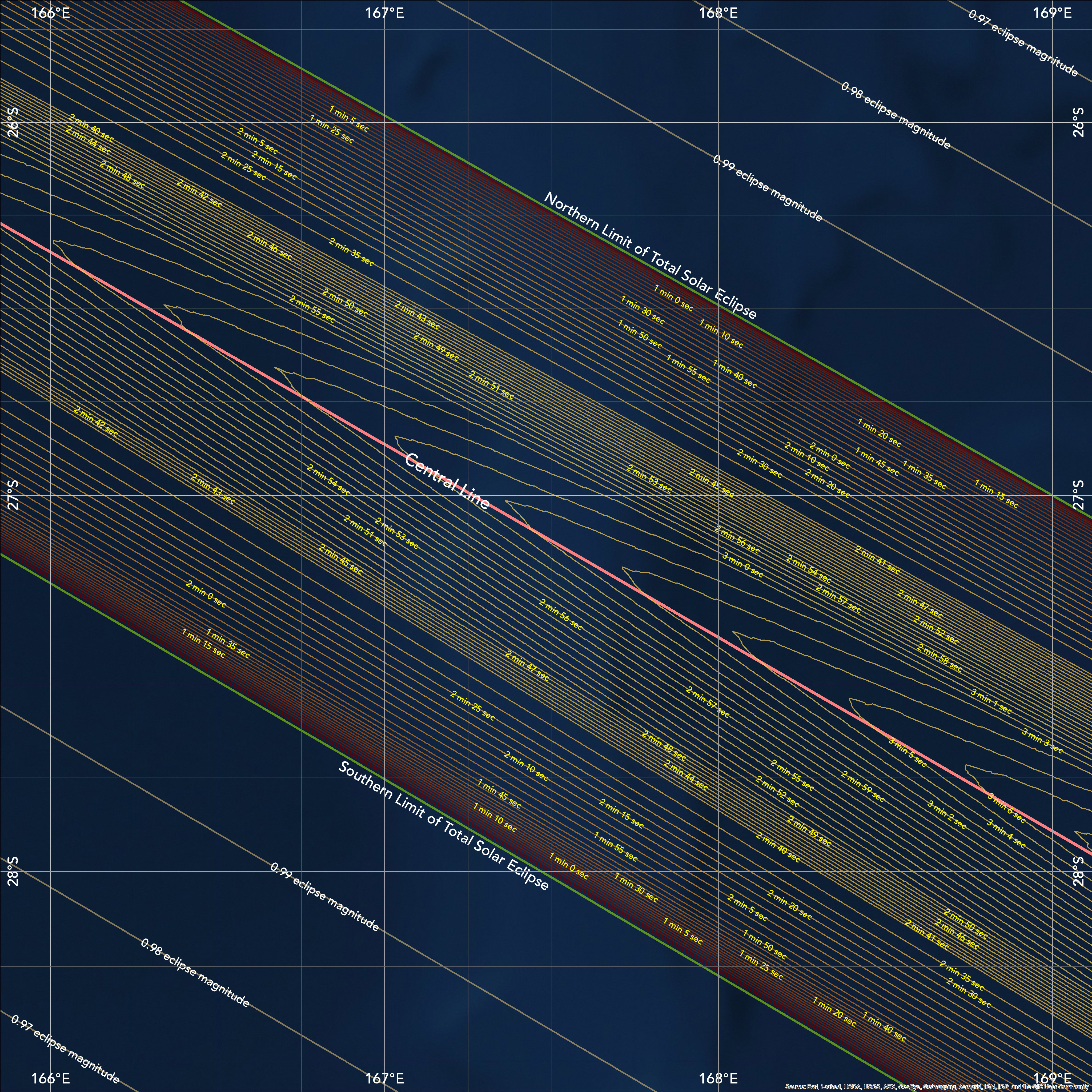
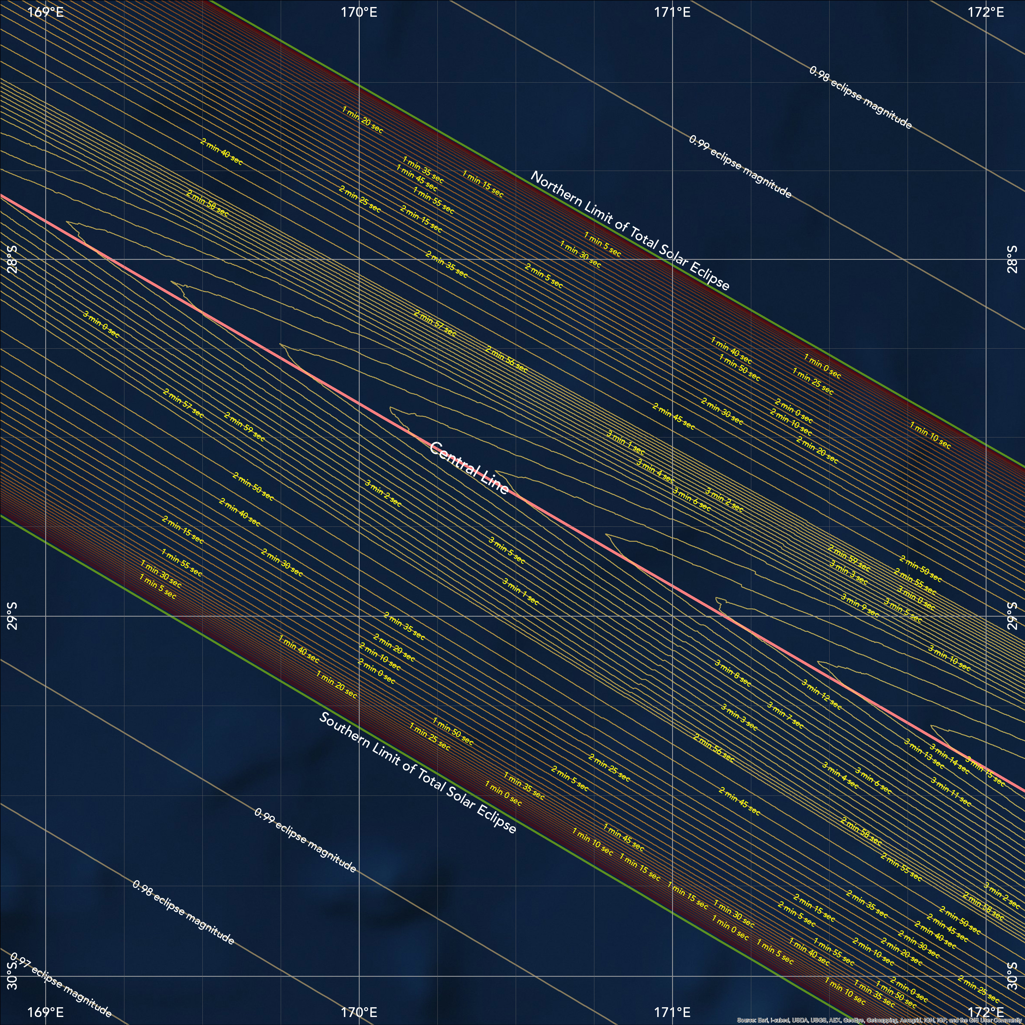
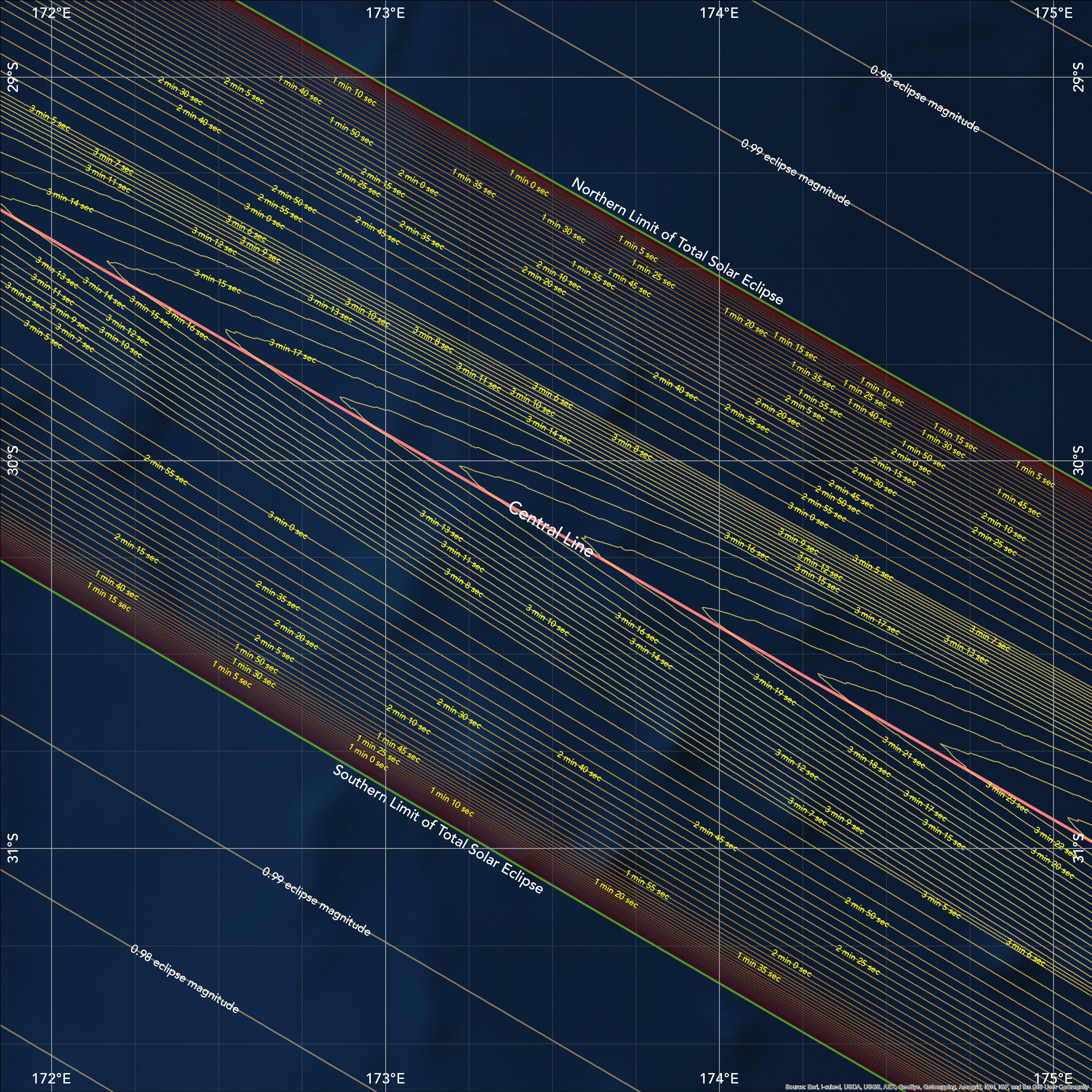
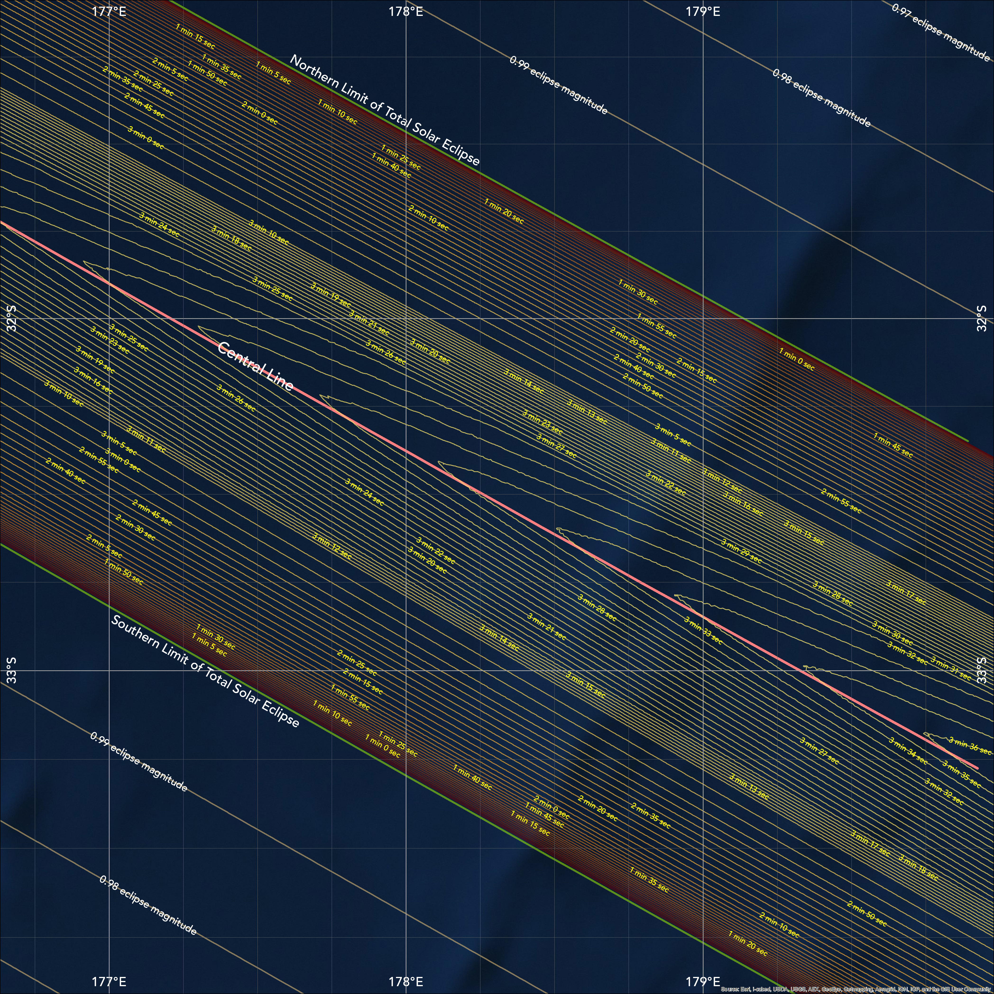
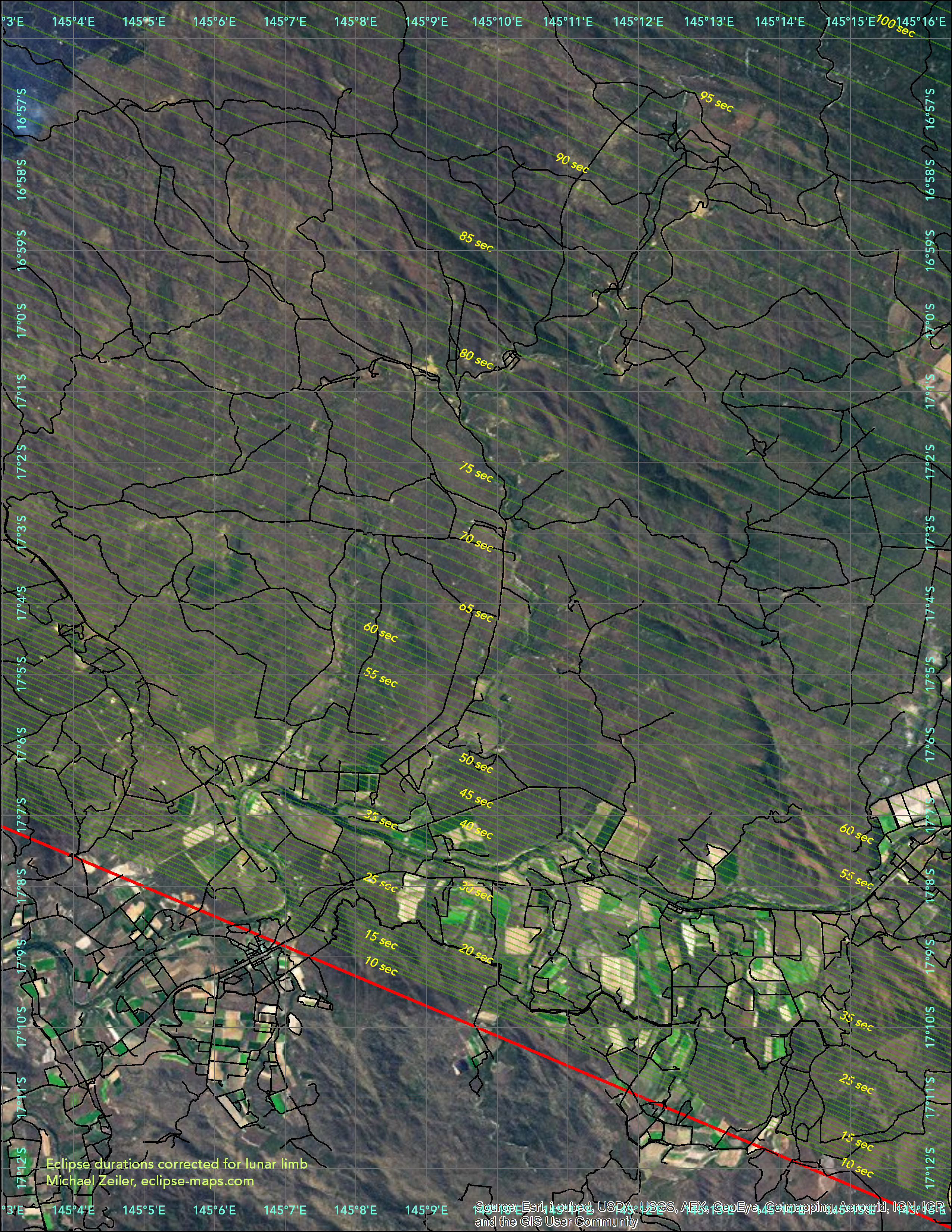
The maps on this web page apply eclipse calculations by Xavier Jubier and Bill Kramer with eclipse timing corrections for the precise profile of the moon. The lunar profile was derived from laser altimeter data from the Japanese Kaguya lunar orbiter by Dave Herald. The eclipse lines were calculated by Xavier Jubier and the Besselian elements used for eclipse calculations are by Jean Meeus and Fred Espenak. The careful map reader will note that the isodurations (lines of equal eclipse duration) on the maps are not symmetric around the central line of eclipse or perfectly smooth; this is due to the corrections for the actual lunar profile.
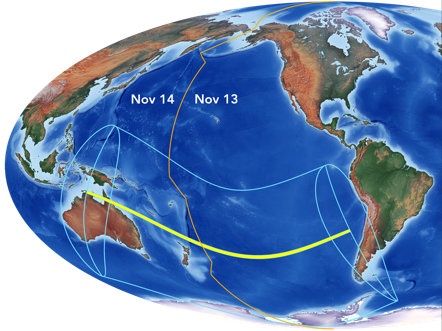
Nearly all observers of the total solar eclipse will be west of the International Date Line where it will be November 14.
Click on map and t-shirt images to see enlargement
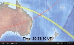
These are two of the six animated maps on my eclipse atlas iBook. Click to view.
These are a selection from the 55 maps in the eclipse atlas iBook. Click on any map to see an enlarged view.
How much of the Sun’s diameter is eclipsed

When the penumbral (partial) eclipse begins
Time of local greatest eclipse
When the penumbral (partial) eclipse ends
How high the Sun is at local greatest eclipse
Dimming of sunshine (obscuration)
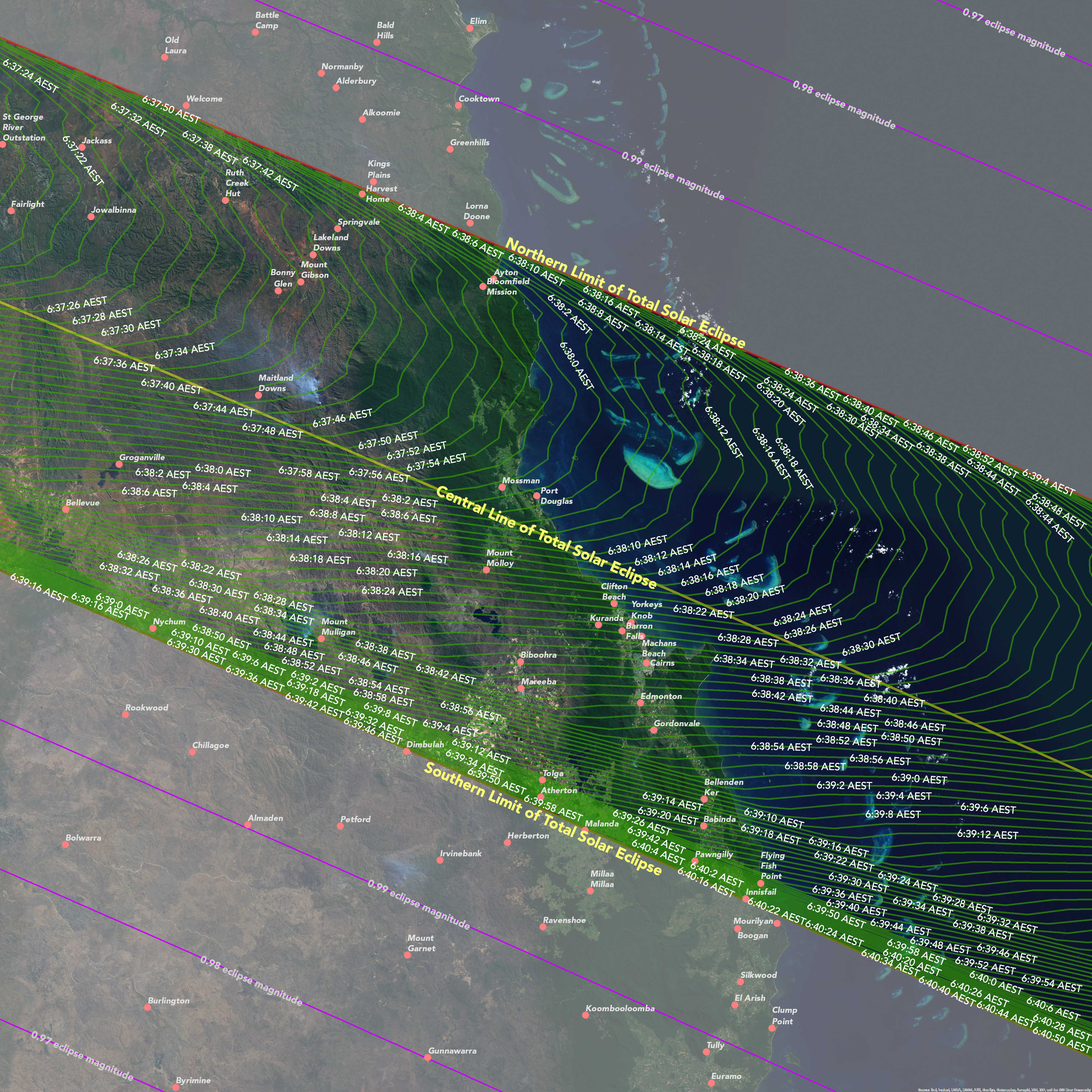

Begin of eclipse in Cairns
End of eclipse in Cairns
Duration of eclipse in Cairns

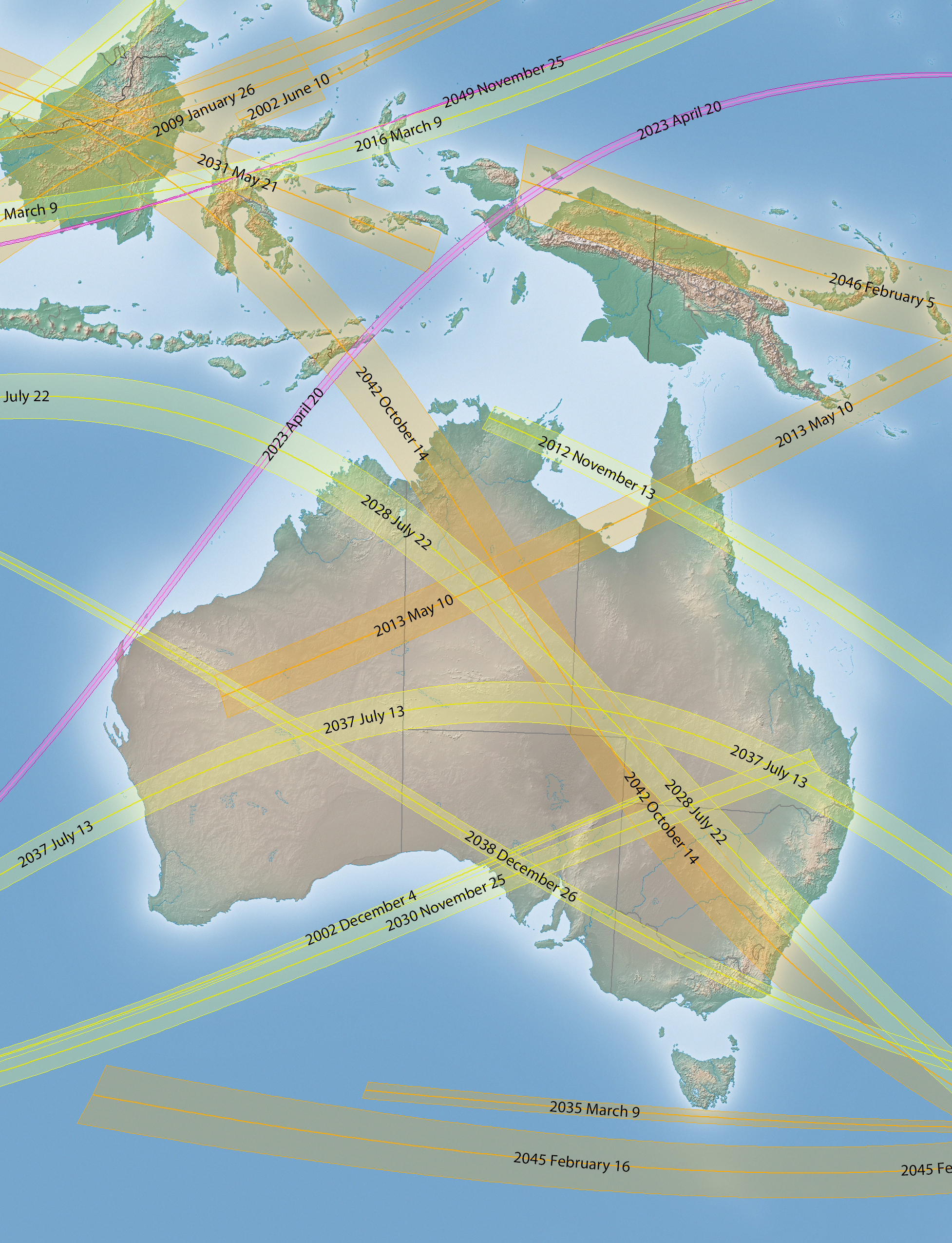
Past and future eclipses in Saros Eclipse Cycle 133
Australia will enjoy an above-average number of eclipses in the coming decades.
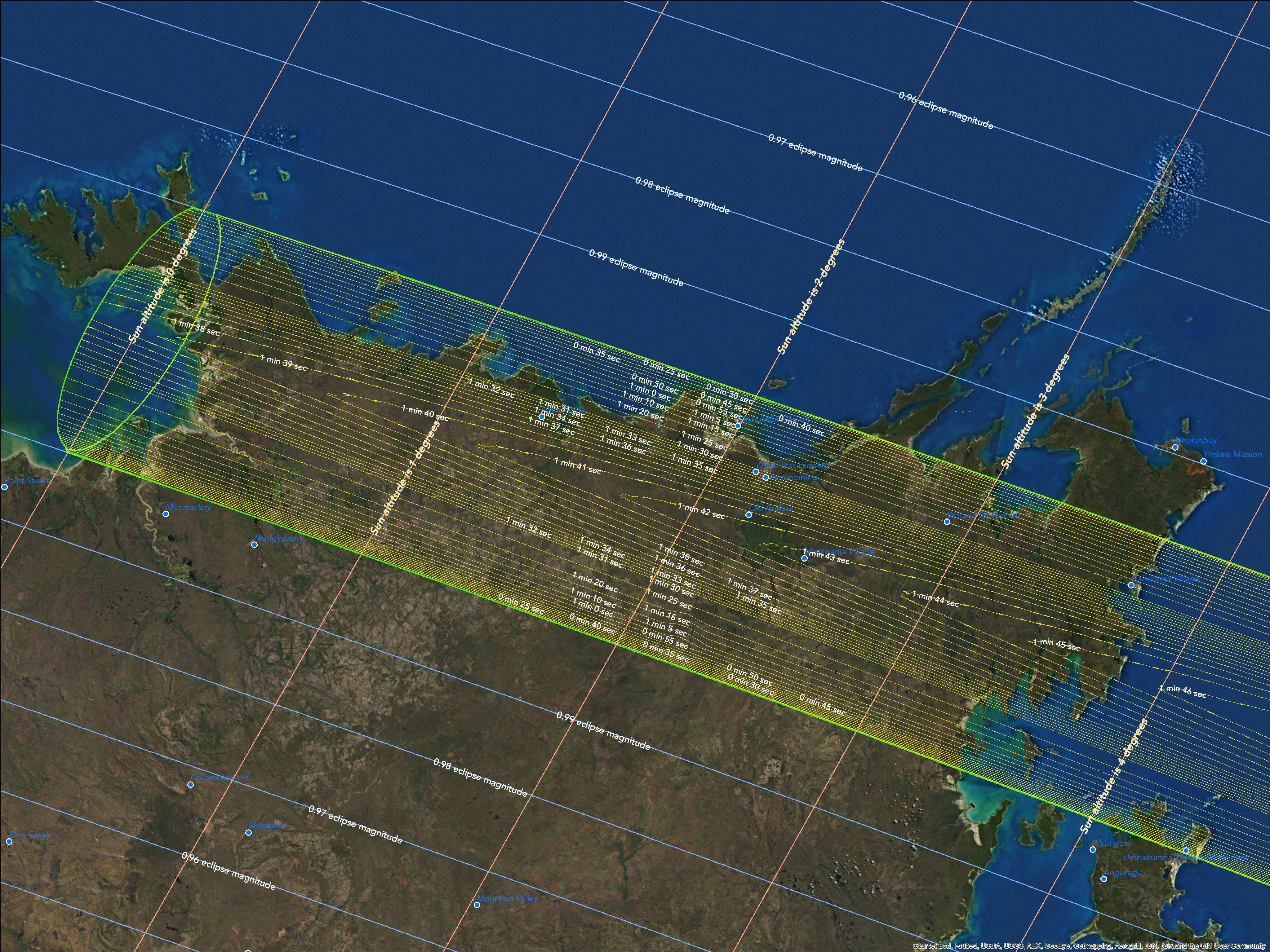
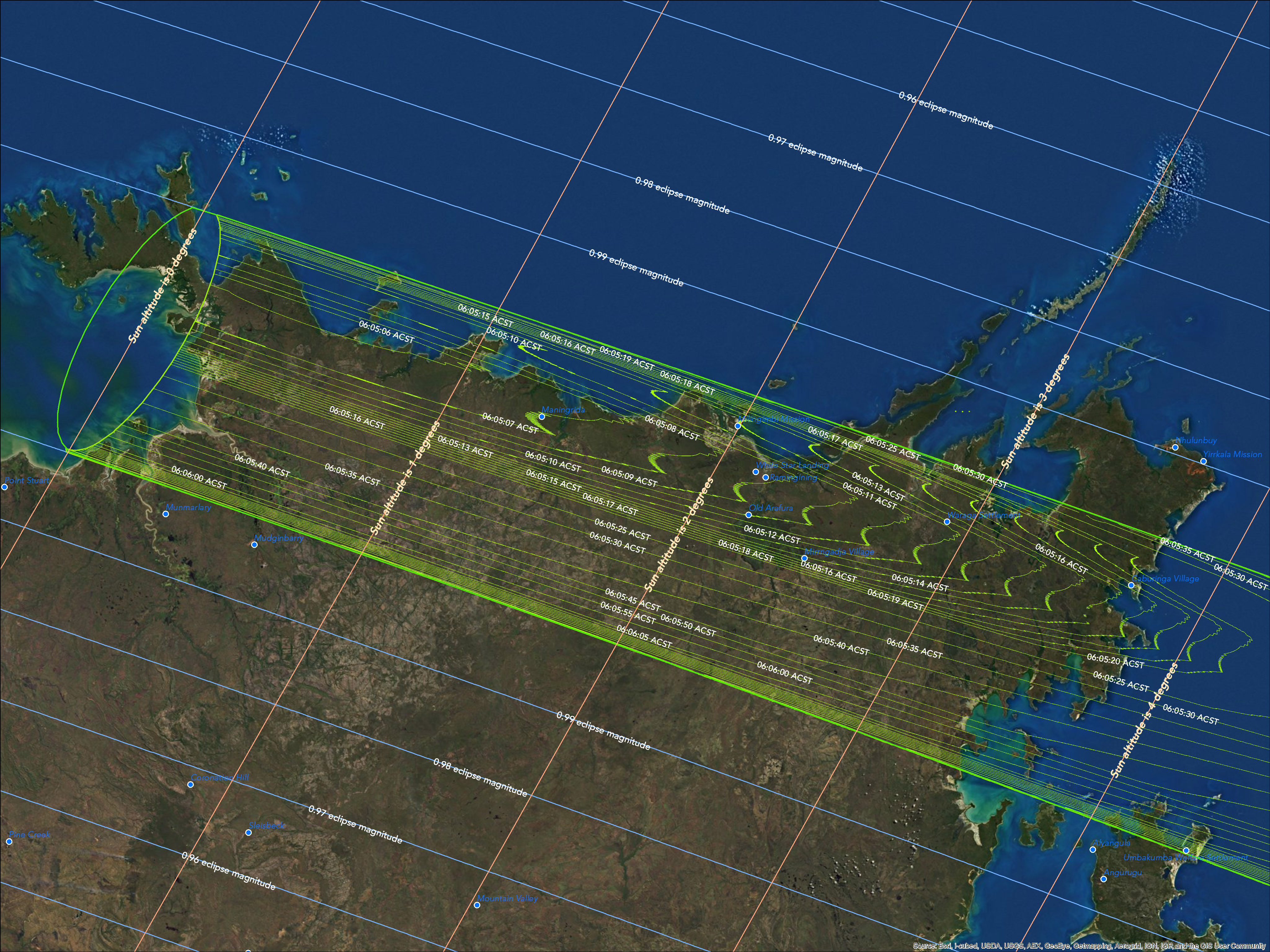
Duration of eclipse in Arnhem Land, northern Australia
Beginning of eclipse in Arnhem Land. Corrections for refraction adds 83 km to west of path
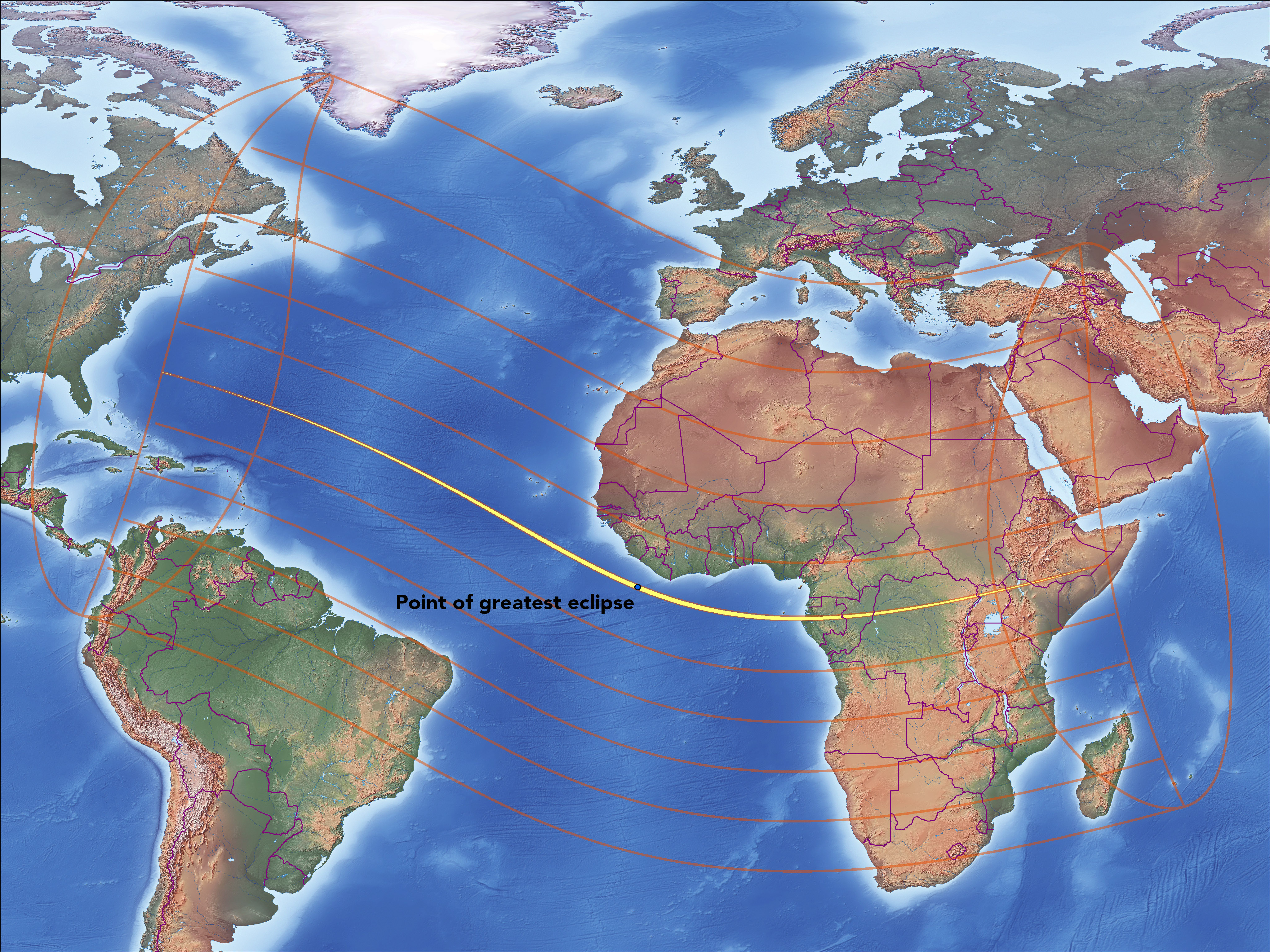
The next solar eclipse passes over Africa on November 3, 2013
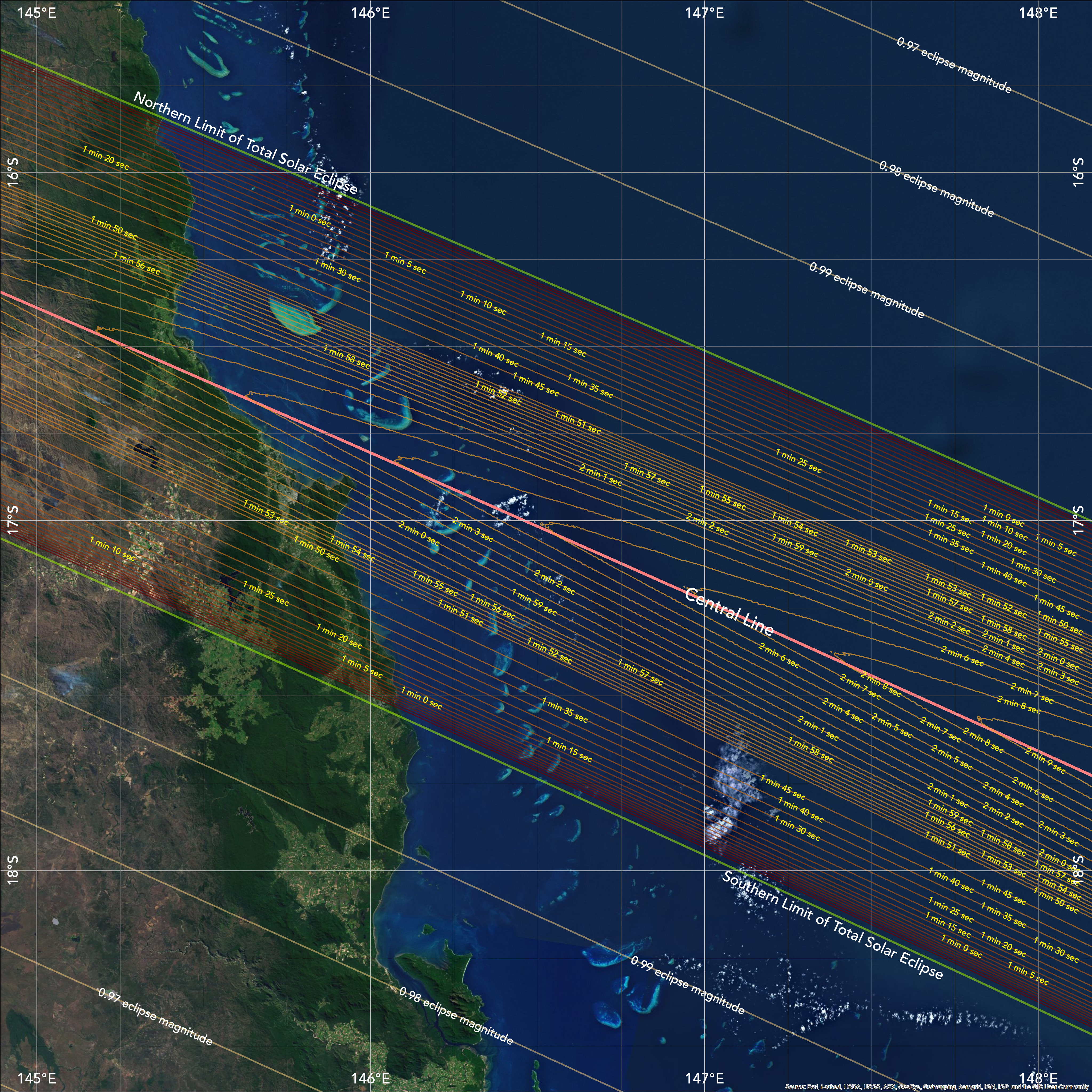

145 E to 148 E longitude
148 E to 151 E longitude
151 E to 154 E longitude
154 E to 157 E longitude
157 E to 160 E longitude
160 E to 163 E longitude
163 E to 166 E longitude
166 E to 169 E longitude
169 E to 172 E longitude
172 E to 175 E longitude
Eclipse maps for use on cruise ships
I made these 10 maps for my iBook, “Total Solar Eclipse of November 14, 2012” but decided to use another set of similar maps at smaller scale. If you are observing the eclipse from a cruise ship, you can identify your location by interpolating along the latitude-longitude grid to determine your eclipse duration and judge how well your captain positioned you for the eclipse.
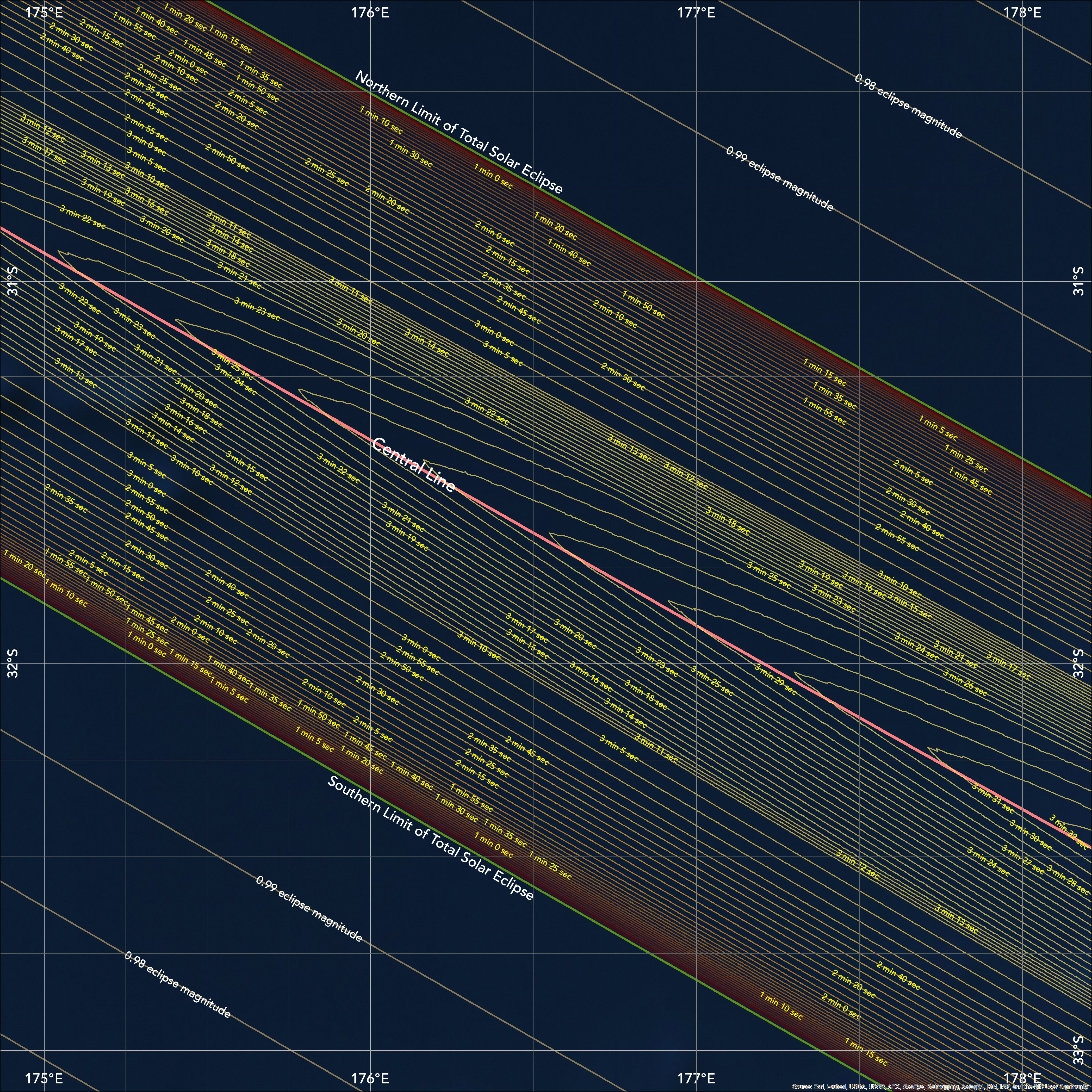
175 E to 178 E longitude
177 E to 180 E longitude
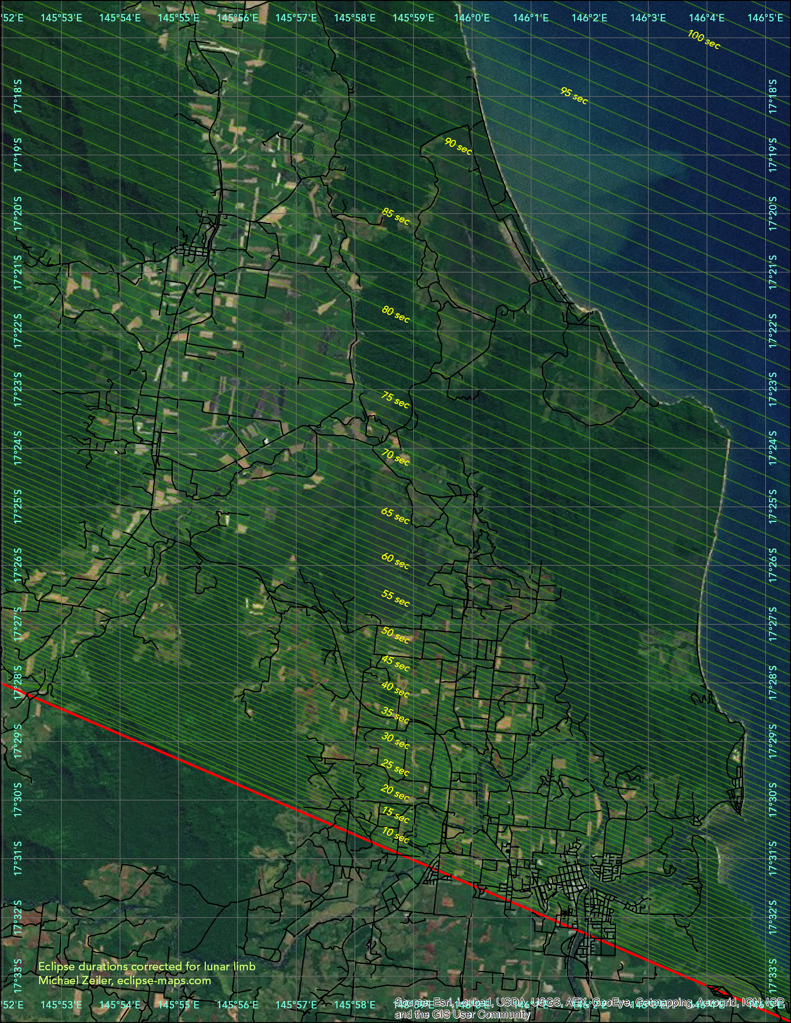
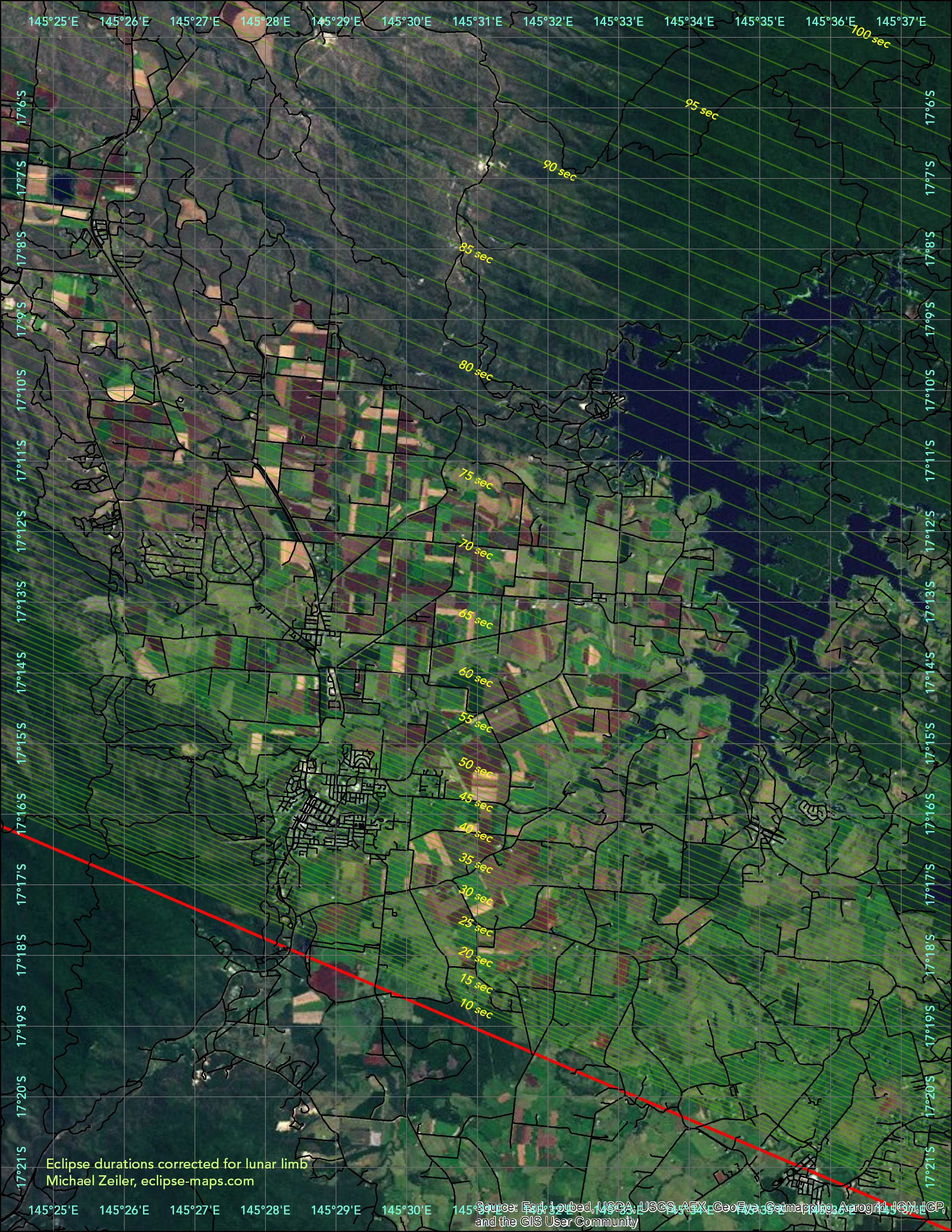
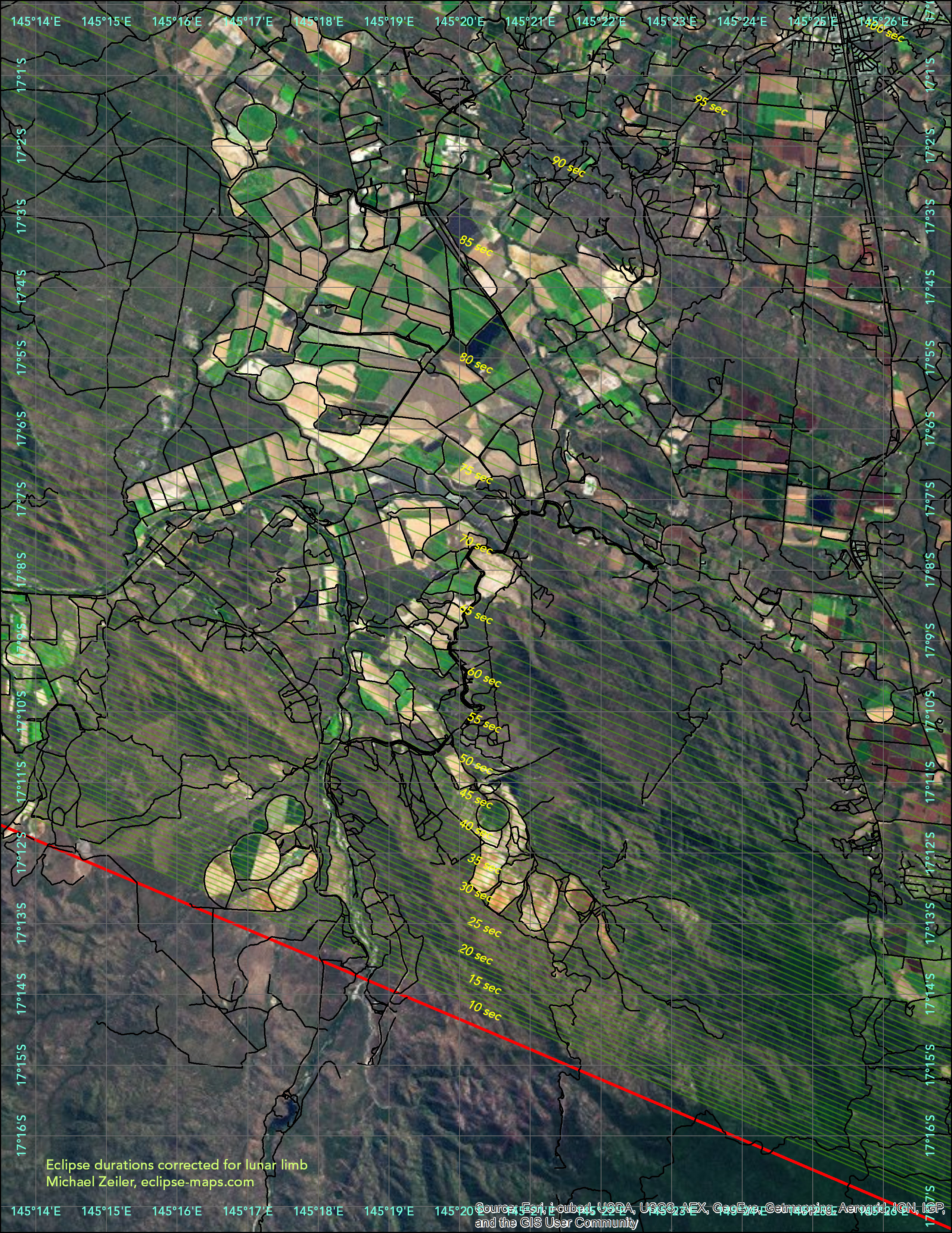
Southern limit, Innisfall
Southern limit, Malanda
Southern limit, Atherton
Southern limit, Piermonte
Southern limit maps
Some eclipse observers will travel to the southern reaches of the area of totality. Their reward will be an extended presentation of the “diamond rings” (the moments when totality begins and ends), a better view of the Sun’s chromosphere (the inner corona containing vivid red prominences and other features), and a dramatic display of Baily’s Beads (the last sparkly bits of the Sun in silhouette). Their sacrifice is a diminished duration of totality, but they judge this to be a fair trade. These maps are for the areas along the southern limit of totality near Cairns that are accessible with cars. If you select a site in these maps, study the predicted appearance and circumstances with Xavier Jubier’s interactive google map at http://xjubier.free.fr/en/site_pages/solar_eclipses/xSE_GoogleMapFull.php?Ecl=+20121113